Welcome to the I Can't Sleep Podcast,
Where I help you drift off one fact at a time.
I'm your host,
Benjamin Boster,
And today's episode is about Shenandoah National Park.
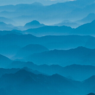
Shenandoah National Park is a national park of the United States that encompasses part of the Blue Ridge Mountains in Virginia.
The park is long and narrow,
With the Shenandoah River and its broad valley to the west and the rolling hills of the Virginia Piedmont to the east.
Skyline Drive is the main park road,
Generally traversing along the ridge line of the mountains.
Almost 40% of the park's land,
79,
579 acres,
Has been designated as wilderness areas and is protected as part of a National Wilderness Preservation System.
The highest peak is Hawksbill Mountain at 4,
051 feet.
As stated in the Foundation document,
Shenandoah National Park preserves and protects nationally significant natural and cultural resources,
Scenic beauty,
And congressionally designated wilderness within Virginia's northern Blue Ridge Mountains,
And provides a broad range of opportunities for public enjoyment,
Recreation,
Inspiration,
And stewardship.
The park encompasses parts of eight counties.
On the west side of Skyline Drive,
They are,
From northeast to southwest,
Warren,
Page,
Rockingham,
And Augusta counties.
On the east side of Skyline Drive,
They are Rappahannock,
Madison,
Green,
And Albemarle counties.
The park stretches for 105 miles along Skyline Drive,
From near the town of Front Royal in the northeast to near the city of Waynesboro in the southwest.
The park headquarters are located in Luray.
Shenandoah National Park lies along the Blue Ridge Mountains in north-central Virginia.
These mountains form a distinct highland rising to elevations above 4,
000 feet.
Local topographic relief between the Blue Ridge Mountains and Shenandoah Valley exceeds 3,
000 feet at some locations.
The crest of the range divides the Shenandoah River drainage basin,
Part of the Potomac River drainage on the west side,
From the James and the Rappahannock River drainage basins on the east side.
Some of the rocks exposed in the park date over one billion years in age,
Making them among the oldest in Virginia.
Bedrock in the park includes Grenville Age granite basement rocks and a sequence of metamorphosed neoproterozoic sedimentary and volcanic rocks of the Swift Run and Catoctin Formations.
Columns of the Catoctin Formation metamorphosed basalt can be seen at Compton Peak.
Clastic rocks of the Chiloé Group are of early Cambrian age.
Quaternary surficial deposits are common and cover much of the bedrock throughout the park.
The park is located along the western part of the Blue Ridge Anticlinorium,
A regional-scale Paleozoic structure at the eastern margin of the Appalachian Fold and Thrust Belt.
Rocks within the park were folded,
Faulted,
Distorted,
And metamorphosed during the late Paleozoic Eleganian Orogeny,
325 to 260 million years ago.
The rugged topography of Blue Ridge Mountains is a result of differential erosion during the Cenozoic,
Although some post-Paleozoic tectonic activity occurred in the region.
Legislation to create a national park in the Appalachian Mountains was first introduced by freshman Virginia Congressman Henry D.
Flood in 1901,
But despite the support of President Theodore Roosevelt,
Failed to pass.
The first national park was Yellowstone in Wyoming,
Montana,
And Idaho.
It was signed into law in 1872.
Yosemite National Park was created in 1890.
When Congress created the National Park Service in 1916,
Additional parks had maintained the western pattern,
Crater Lake in 1902,
Wind Cave in 1903,
Mesa Verde in 1906,
Then Denali in 1917.
Grand Canyon,
Zion,
And Acadia were all created in 1919 during the administration of the Virginia-born President Woodrow Wilson.
Acadia finally broke the western mold,
Becoming the first eastern national park.
It was also based on donations from wealthy private landowners.
Stephen Mather,
The first NPS director,
Saw a need for a national park in the southern states and solicited proposals in his 1923 year-end report.
In May 1926,
Congress and President Calvin Coolidge authorized the NPS to acquire a minimum of 250,
000 acres.
And a maximum of 521,
000 acres to form the Shenandoah National Park.
It also authorized creation of Great Smoky Mountains National Park.
However,
The legislation also required that no federal funds would be used to acquire the land.
Thus,
Virginia needed to raise private funds and could also authorize state funds and use its eminent domain power to acquire the land to create Shenandoah National Park.
Virginia's Democratic gubernatorial candidate and the late Congressman Flood's nephew,
Harry F.
Byrd,
Supported the creation of Shenandoah National Park,
As did his friend William E.
Carson,
A businessman who had become Virginia's first chairman of the Commission on Conservation and Development.
Development of the Western National Parks had assisted tourism,
Which produced jobs,
Which Byrd and local politicians supported.
The land that became Shenandoah Park was scenic,
Mountainous,
And had also lost about half of its trees to the chestnut blight,
Which was incurable and affected trees as they reached maturity.
However,
It had been held as private property for over a century,
So many farms and orchards existed.
After Byrd became governor and convinced the legislature to appropriate $1 million for land acquisition and other work,
Carson and his team,
Including surveyors and his brother Kidd,
Who was Byrd's law partner,
Tried to figure out who owned the land.
They found that it consisted of more than 5,
000 parcels,
Some of them inhabited by tenant farmers or squatters who were ineligible to receive compensation.
Some landowners,
Including wealthy resort owner George Freeman Pollack and Luray realtor and developer L.
Ferdinand Zirkle,
Had long wanted the park created,
And had formed the Northern Virginia Park Association to win over the National Park Selection Committee.
However,
Many local families who had lived in the area for generations,
Especially people over 60 years old,
Did not want to sell their land,
And some refused to sell at any price.
Carson promised that if they sold to the Commonwealth,
They could still live on their homesteads for the rest of their lives.
Carson also lobbied the new president,
Herbert Hoover,
Who bought land to establish a vacation fishing camp near the headwaters of the Rapidan River,
And would ultimately donate it to the park as he left office.
It remains as Rapidan Camp.
The Commonwealth of Virginia slowly acquired the land through eminent domain,
Eventually giving it to the U.
S.
Federal government to establish the National Park.
Carson's brothers suggested that Virginia's legislature authorize condemnation by counties,
Rather than condemn each parcel.
Some families accepted the payments because they needed the money,
And wanted to escape the subsistence lifestyle.
Nearly 90% of the inhabitants worked the land for a living,
Selling timber,
Charcoal,
Or crops.
They had previously been able to earn money to buy supplies by harvesting the now rare chestnuts,
By working during the apple and peach harvest season,
Or by selling handmade textiles and crafts,
And moonshine.
However,
Carson and the politicians did not seek citizen input early in the process,
Nor convince residents that they could live better in a tourist economy.
Instead,
They started with an advertising campaign to raise the funds,
And courthouse property evaluations and surveys.
Upon Mather's death in 1929,
The new NPS director,
Horace M.
Albright,
Also decided that the federal agency would only accept vacant land,
So even elderly residents would be forced to leave.
Thus,
Many families and entire communities were forced to vacate portions of the Blue Ridge Mountains in eight Virginia counties.
Although the Skyline Drive right-of-way was purchased from owners without condemnation,
The costs of the acreage purchased trebled over initial estimates,
And the acreage decreased to what Carson called a fishbone shape,
And others a shoestring.
Although Byrd and Carson convinced Congress to reduce the minimum size of Shenandoah Park to just over 160,
000 acres,
To eliminate some high-priced lands,
In 1933,
Newly elected President Franklin D.
Roosevelt decided to also create the Blue Ridge Parkway to connect his then under-construction Skyline Drive on the Shenandoah National Park Ridgeline,
Which required additional condemnations.
The park is best known for Skyline Drive,
A 105-mile road that runs the length of the park along the ridge of the mountains.
101 miles of the Appalachian Trail are also in the park.
In total,
There are over 500 miles of trails within the park.
There is also horseback riding,
Camping,
Bicycling,
And a number of waterfalls.
The Skyline Drive is the first National Park Service road east of the Mississippi River,
Listed as a National Historic Landmark on the National Register of Historic Places.
It is also designated as a National Scenic Byway.
Shenandoah National Park offers 196,
000 acres of backcountry and wilderness camping.
Backcountry campers must also be careful of wildlife such as bears and venomous snakes.
Campers must suspend their food from trees while not in use in bear bags or park-approved bear canisters.
To prevent unintentionally feeding the bears,
Who then become habituated to humans and their food and therefore dangerous.
All animals are protected by federal law.
Most of the campgrounds are open from April to October through November.
There are five major campgrounds.
Matthews Arm Campground Big Meadows Campground Lewis Mountain Campground Loft Mountain Campground Dundoe Group Campground There are several lodges or cabins in the park.
Skyland Resort Big Meadows Lewis Mountain Cabins Potomac Appalachian Trail Club Public Use Cabins Lodges are located at Skyland and Big Meadows.
The park's Henry F.
Bird Visitor Center is also located at Big Meadows.
Another visitor center is located at Dickey Ridge.
Campgrounds are located at Matthews Arm,
Big Meadows,
Lewis Mountain,
And Loft Mountain.
Rapidan Camp,
The restored presidential fishing retreat Herbert Hoover built on the Rapidan River in 1929,
Is accessed by a 4.
1-mile round-trip hike on Mill Prong Trail,
Which begins on the Skyline Drive at Millum Cab.
The NPS also offers guided van trips that leave from the Bird Center at Big Meadows.
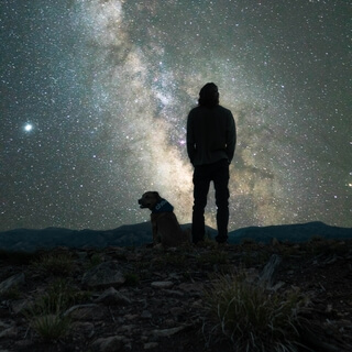
Shenandoah National Park is one of the most dog-friendly in the National Park System.
The campgrounds all allow dogs,
And dogs are allowed on almost all the trails,
Including the Appalachian Trail,
If kept on leash.
Dogs are not allowed on 10 trails.
Fox Hollow Trail Stony Man Trail Limberlost Trail Post Office Junction to Old Rag Shelter Old Rag Ridge Trail Old Rag Saddle Trail Dark Hollow Falls Trail Story of the Forest Trail Peer Fence Mountain Trail Fraser Discovery Trail These 10 trails fall short of a total of 20 miles of the 500 miles of trails of the Shenandoah National Park.
Streams and rivers in the park are very popular with fly fishermen for native brook trout.
Beginning at mile 50.
7 of the Skyline Drive near the Bird Visitor Center,
Dark Hollow Falls Trail leads downhill beside Hog Camp Branch to Dark Hollow Falls at 70 feet cascade.
The distance from the trailhead to the base of the falls is 0.
7 miles,
Although the trail continues beyond that point,
Crossing the creek and connecting with the Rose River Fire Road.
Various fauna can be viewed along the trail,
Including occasional sightings of black bears and timber rattlesnakes.
While the trail is relatively short,
Parts of it are steep and may prove challenging to some visitors.
There is no view from the brink of the falls,
And slippery rocks make it inadvisable to leave the trail.
According to the Curpin Climate Classification System,
Shenandoah National Park has a humid continental climate,
With warm summers and no dry season.
According to the United States Department of Agriculture,
The plant hardiness zone at Big Meadows Visitor Center is 6A,
With an average annual extreme minimum temperature of negative 7.
1 degrees Fahrenheit.
The climate of the park and its flora and fauna are typical for mountainous regions of the eastern mid-Atlantic woodland,
While a large portion of common species are also typical of ecosystems at lower altitudes.
A.
W.
Cookler's potential natural vegetation type for the park is Appalachian Oak 104,
With an eastern hardwood forest vegetation form 25,
Also known as a temperate broadleaf and mixed forest.
Pines predominate on the southwestern faces of some of the southernmost hillsides,
Where an occasional prickly pear cactus may also grow naturally.
In contrast,
Some of the northeastern aspects are most likely to have small but dense stands of moisture-loving hemlocks and mosses in abundance.
Other commonly found plants include oak,
Hickory,
Chestnut,
Maple,
Tulip poplar,
Mountain laurel,
Milkweed,
Daisies,
And many species of ferns.
The once predominant American chestnut tree was effectively brought to extinction by a fungus,
Known as the chestnut blight,
During the 1930s.
Though the tree continues to grow in the park,
It does not reach maturity and dies back before it can reproduce.
Various species of oaks superseded the chestnuts and became the dominant tree species.
Gypsy moth infestations beginning in the early 1990s began to erode the dominance of the oak forests,
As the moths would primarily consume the leaves of oak trees.
Though the gypsy moths seem to have abated,
They continue to affect the forest and have destroyed almost 10% of oak groves.
Mammals include black bear,
Coyote,
Striped skunk,
Spotted skunk,
Raccoon,
Beaver,
River otter,
Opossum,
Woodchuck,
Bobcat,
Two species of foxes,
White-tailed deer,
And eastern cottontail rabbit.
Though unsubstantiated,
There have been some reported sightings of cougar in remote areas of the park.
Over 200 species of birds make their home in the park for at least part of a year.
About 30 live in the park year-round,
Including the barred owl,
Carolina chickadee,
Red-tailed hawk,
And wild turkey.
The peregrine falcon was reintroduced in the park in the mid-1990s,
And by the end of the 20th century there were numerous nesting pairs in the park.
32 species of fish have been documented in the park,
Including brook trout,
Longnose and eastern blacknose dace,
And the bluehead chub.
Park rangers organize several programs from spring to fall.
These include ranger-led hikes,
As well as discussions of the history,
Flora,
And fauna.
Shenandoah Live is an online series where listeners may chat live with rangers and learn about some of the park's features.
Rangers discuss a wide range of topics while answering questions and talking with experts from the field.
In 2014,
Under the leadership of Superintendent Jim Northup,
Shenandoah National Park established an artist-in-residence program that is administered by the Shenandoah National Park Trust,
The park's philanthropic partner.
Photographer Sandy Long was selected as the park's first artist-in-residence.
The results of Long's residency were featured in the photography exhibit Wild Beauty,
The Artful Nature of Shenandoah National Park,
Held at the Looking Glass Art Gallery in the historic Holly Silk Mill in Holly,
Pennsylvania.
The Shenandoah River is the principal tributary of the Potomac River,
55.
6 miles long,
With two forks approximately 100 miles long each in the U.
S.
States of Virginia and West Virginia.
The river and its tributaries drain the central and lower Shenandoah Valley in the Page Valley and the Appalachians on the west side of the Blue Ridge Mountains in northwestern Virginia and the eastern panhandle of West Virginia.
There is a hydroelectric plant along the Shenandoah River,
Constructed in 2014 by Dominion.
The Shenandoah River is formed northeast of Front Royal near Riverton by the confluence of the South Fork and the North Fork.
It flows northeast across Warren County,
Passing underneath Interstate 66,
One mile from its formation.
Beyond the I-66 bridge,
The river flows through a set of bends before turning to the northeast again,
Crossing into Clark County 11 miles below I-66.
Five miles downriver from the Clark County border,
The Shenandoah passes under U.
S.
Route 50 and then passes through a triple bend.
14.
5 miles below the Route 50 bridge,
The river passes underneath State Route 7 and then continues northeast another 8 miles,
Where it crosses into Jefferson County in West Virginia.
Once in West Virginia,
The river completes six large bends before joining the Potomac from the southwest near Harpers Ferry.
The confluence is on the West Virginia-Maryland border,
M.
4 miles from the Virginia-West Virginia border.
The Shenandoah Valley is underlaid by limestone.
The fertile soil made it a favored place for early settlement.
It remains a major agricultural area of Virginia and West Virginia.
Some karst topography is evident,
And the limestone is honeycombed with caves.
Several have been developed as commercial tourist attractions,
Including Luray Caverns,
Shenandoah Caverns,
And Skyline Caverns.
On the riverbank a few miles above Harpers Ferry is said to be a cave with an opening just large enough for a mounted rider to squeeze through.
It widened in the interior to a spacious room,
Where hundreds of Col.
John Mosby's raiding troops are said to have hidden from pursuing Union cavalry.
Various accounts tell the origin of the name.
According to one,
General George Washington named the valley and river in honor of Skenandoah,
Or Shenandoah,
An Oneida pine tree chief based in New York who led hundreds of Oneida and Tuscarora warriors in support of the American rebels on the frontier during the Revolutionary War.
He also sent much-needed corn to Washington and his troops during their hard winter at Valley Forge,
Pennsylvania,
In 1777-1778.
However,
The name was in use when Washington was a child,
As evidenced in land grants and correspondence.
It is also said to be named after the Senedo people,
A little-documented tribe said to have lived on the north fork of the river and destroyed by the Catawba sometime between 1650 and 1700.
The Shenandoah River is a very popular river for canoeing,
River tubing,
And whitewater recreation,
Such as rafting and kayaking,
And several commercial outfitters offer a variety of guided trips and rentals.
The South Fork is formed at Port Republic in southern Rockingham County by the confluence of the North River and South River.
It flows 98.
5 miles northeast in a tight,
Meandering course past Elkton and Shenandoah through Page Valley with the Blue Ridge Mountains to the east and the Massanutten Mountains range to the west.
The North Fork is 105 miles long and rises in northern Rockingham County along the eastern flank of Shenandoah Mountain in George Washington National Forest.
At its formation,
The principal feature on the North Fork is the German River.
The North Fork flows initially southeast,
Down from the mountains,
Then northeast through a valley across Shenandoah County along the western side of Massanutten Mountain.
It flows past Woodstock and Strasburg.
On the north end of the ridge,
It turns briefly southeast to join the South Fork from the northwest to form the Shenandoah.
In popular culture,
The American folk song and river and sea shanty titled O Shenandoah has been adapted to explicitly reference the river or river valley,
Although earlier versions referred to the 18th century Oneida Chief Shenandoah and the Missouri River,
1,
000 miles to the west.
The 1971 hit and signature song of John Denver,
Take Me Home Country Roads,
Prominently mentions the Shenandoah River and was adopted by the state of West Virginia in 2014 as its fourth official state song.