Welcome to the I Can't Sleep Podcast,
Where I help you drift off one fact at a time.
I'm Benjamin Boster,
And tonight I'll be reading from a Wikipedia article about the Columbia River in my calm,
Soothing voice.
Let's take a moment to settle in.
You can take a deep breath and get comfortable if you'd like.
And let's begin.
The Columbia River,
Upper Chinook,
Weemal,
Sahaptin,
Hinchiwana,
Synyx dialect,
Tswanent'ku,
Is the largest river in the Pacific Northwest region of North America.
The river forms in the Rocky Mountains of British Columbia,
Canada.
It flows northwest and then south into the U.
S.
State of Washington,
Then turns west to form most of the border between Washington and the state of Oregon before emptying into the Pacific Ocean.
The river is 1,
243 miles long,
And its largest tributary is the Snake River.
Its drainage basin is roughly the size of France and extends into seven states of the United States and one Canadian province.
The fourth largest river in the United States by flow,
The Columbia has the greatest flow of any river in the eastern Pacific.
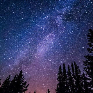
The Columbia and its tributaries have been central to the region's culture and economy for thousands of years.
They have been used for transportation since ancient times,
Linking the region's many cultural groups.
The river system hosts many species of anadromous fish,
Which migrate between freshwater habitats and the saline waters of the Pacific Ocean.
These fish,
Especially the salmon species,
Provided the core subsistence for native peoples.
The first documented European discovery of the Columbia River occurred when Bruno de Heceta sighted the river's mouth in 1775.
On May 11,
1792,
A private American ship,
Columbia Rediviva,
Under Captain Robert Gray from Boston,
Became the first non-indigenous vessel to enter the river.
Later in 1792,
William Robert Broughton of the British Royal Navy,
Commanding HMS Chatham as part of the Vancouver Expedition,
Navigated past the Oregon Coast Range and 100 miles upriver to what is now Vancouver,
Washington.
In the following decades,
Fur trading companies used the Columbia as a key transportation route.
Overland explorers entered the Willamette Valley through the scenic but treacherous Columbia River Gorge,
And pioneers began to settle in the valley in increasing numbers.
Steam ships along the river linked communities and facilitated trade.
The arrival of railroads in the late 19th century,
Many running along the river,
Supplemented these links.
Since the late 19th century,
Public and private sectors have extensively developed the river.
To aid ship and barge navigation,
Locks have been built along the lower Columbia and its tributaries,
And dredging has opened,
Maintained,
And enlarged shipping channels.
Since the early 20th century,
Dams have been built across the river for power generation,
Navigation,
Irrigation,
And flood control.
The 14 hydroelectric dams on the Columbia's main stem,
And many more on its tributaries,
Produce more than 44% of total U.
S.
Hydroelectric generation.
The Columbia begins its 1,
243-mile,
Or 2,
000-kilometer journey in the southern Rocky Mountain Trench in British Columbia,
B.
C.
Columbia Lake,
2,
690 feet,
Or 820 meters above sea level,
And the adjoining Columbia wetlands form the river's headwaters.
The trench is a broad,
Deep,
And long glacial valley between the Canadian Rockies and the Columbia Mountains in B.
C.
For its first 200 miles,
Or 320 kilometers,
The Columbia flows northwest along the trench through Windermere Lake and the town of Invermere,
A region known in B.
C.
As the Columbia Valley,
Then northwest to Golden and into Kimbasket Lake.
Rounding the northern end of Selkirk Mountains,
The river turns sharply south through a region known as the Big Bend Country,
Passing through Revelstoke Lake and the Arrow Lakes.
Revelstoke,
The Big Bend,
And the Columbia Valley combined are referred to in B.
C.
Parlance as the Columbia Country.
Below the Arrow Lakes,
The Columbia passes the cities of Castlegar,
Located at the Columbia's confluence with the Kootenai River and Trail,
Two major population centers of the West Kootenai region.
The Penned Oriel River joins the Columbia about two miles north of the United States-Canada border.
The Columbia enters eastern Washington,
Flowing south and turning to the west at the Spokane River confluence.
It marks the southern and eastern borders of the Colville Indian Reservation and the western border of the Spokane Indian Reservation.
The river turns south after the Okanagan River confluence,
Then southeasterly near the confluence with the Wenatchee River in central Washington.
This C-shaped segment of the river is also known as the Big Bend.
During the Missoula floods 10,
000 to 15,
000 years ago,
Much of the floodwater took a more direct route south,
Forming the ancient river bend known as the Grand Coulee.
After the floods,
The river found its present course,
And the Grand Coulee was left dry.
The construction of the Grand Coulee Dam in the mid-20th century impounded the river,
Forming Lake Roosevelt,
From which water was pumped into the Dry Coulee,
Forming the reservoir of Banks Lake.
The river flows past the Gorge Amphitheater,
A prominent concert venue in the northwest,
Then through Priest Rapids Dam,
And then through the Hanford Nuclear Reservation.
Entirely within the reservation is Hanford Reach,
The only U.
S.
Stretch of the river that is completely free-flowing,
Unimpeded by dams,
And not a tidal estuary.
The Snake River and Yakima River join the Columbia in the Tri-Cities Population Center.
The Columbia makes a sharp bend to the west at the Washington-Oregon border.
The river defines that border for the final 309 miles of its journey.
The Deschutes River joins the Columbia near the Dalles.
Between the Dalles and Portland,
The river cuts through the Cascade Range,
Forming the dramatic Columbia River Gorge.
Via the gorge,
The Columbia crosses the Cascades at a lower elevation than any other river.
The gorge is known for its strong and steady winds,
Scenic beauty,
And its role as an important transportation link.
The river continues west,
Bending sharply to the north-northwest near Portland and Vancouver-Washington at the Willamette River Confluence.
Here the river slows considerably,
Dropping sediment that might otherwise form a river delta at the Columbia's mouth.
Near Longview-Washington and the Cowlitz River Confluence,
The river turns west again.
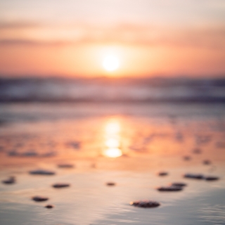
The Columbia empties into the Pacific Ocean just west of Astoria-Oregon over the Columbia Bar,
A shifting sandbar that makes the river's mouth one of the most hazardous stretches of water to navigate in the world.
Because of the danger and the many shipwrecks near the mouth,
It acquired a reputation as the graveyard of ships.
The Columbia drains an area of about 258,
000 square miles.
Its drainage basin covers nearly all of Idaho,
Large portions of British Columbia,
Oregon,
And Washington,
And ultimately all of Montana west of the Continental Divide,
And small portions of Wyoming,
Utah,
And Nevada.
The total area is similar to the size of France.
Roughly 745 miles of the river's length,
And 85% of its drainage basin are in the U.
S.
The Columbia is the 12th longest river and has the 6th largest drainage basin in the United States.
In Canada,
Where the Columbia flows for 498 miles and drains 39,
700 square miles,
The river ranks 23rd in length,
And the Canadian part of its basin ranks 13th in size among Canadian basins.
The Columbia shares its name with nearby places,
Such as British Columbia,
As well as with landforms and bodies of water.
With an average flow at the mouth of about 265,
000 cubic feet per second,
The Columbia is the largest river by discharge flowing into the Pacific from the Americas,
And is the 4th largest by volume in the U.
S.
The average flow where the river crosses the international border between Canada and the United States is 99,
000 cubic feet per second,
From a drainage basin of 39,
700 square miles.
This amounts to about 15% of the entire Columbia watershed,
The Columbia's highest recorded flow,
Measured at the Dalles,
Was 1,
240,
000 cubic feet per second in June 1894,
Before the river was dammed.
The lowest flow recorded at the Dalles was 12,
100 cubic feet per second on April 16,
1968,
And was caused by the initial closure of the John Day Dam,
28 miles upstream.
The Dalles is about 190 miles from the mouth.
The river at this point drains about 237,
000 square miles,
Or about 91% of the total watershed.
Flow rates on the Columbia are affected by many large upstream reservoirs,
Many diversions for irrigation,
And on the lower stretches,
Reverse flow from the tides of the Pacific Ocean.
The National Ocean Service observes water levels at six tide gauges,
And issues tide forecasts for 22 additional locations along the river,
Between the entrance at the North Jetty and the base of Bonneville Dam,
Its head of tide.
When the rifting of Pangaea due to the process of plate tectonics pushed North America away from Europe and Africa and into the Panthalassic Ocean,
Ancestor to the modern Pacific Ocean,
The Pacific Northwest was not part of the continent.
As the North American continent moved westward,
The Farallon Plate subducted under its western margin.
As the plate subducted,
It carried along island arcs,
Which were accreted to the North American continent,
Resulting in the creation of the Pacific Northwest between 150 and 90 million years ago.
The general outline of the Columbia Basin was not complete until between 60 and 40 million years ago,
But it lay under a large inland sea,
Later subject to uplift.
Between 50 and 20 million years ago,
From the Eocene through the Miocene eras,
Tremendous volcanic eruptions frequently modified much of the landscape traversed by the Columbia.
The lower reaches of the Ancestral River pass through a valley near where Mount Hood later arose.
Carrying sediments from erosion and erupting volcanoes,
It built a two-mile thick delta that underlies the foothills on the east side of the coast range,
Near Vernonia in northwestern Oregon.
Between 17 million and 6 million years ago,
Huge outpourings of flood basalt lava covered the Columbia River Plateau and forced the lower Columbia into its present course.
The modern Cascade Range began to uplift 5 to 4 million years ago.
Cutting through the uplifting mountains,
The Columbia River significantly deepened the Columbia River Gorge.
The river and its drainage basin experienced some of the world's greatest known catastrophic floods towards the end of the last ice age.
The periodic rupturing of ice dams at glacial Lake Missoula resulted in the Missoula floods,
With discharges exceeding the combined flow of all the other rivers in the world dozens of times over thousands of years.
The exact number of floods is unknown,
But geologists have documented at least 40.
Evidence suggests that they occurred between about 19,
000 and 13,
000 years ago.
The floodwaters rushed across eastern Washington,
Creating the channeled scablands,
Which are a complex network of dry canyon-like channels,
Or coulis that are often braided and sharply gouged into the basalt rock underlying the region's deep topsoil.
Numerous flat-top buttes with rich soil stand high above the chaotic scablands.
Constrictions at several places caused the floodwaters to pool into large temporary lakes,
Such as Lake Lewis,
In which sediments were deposited.
Water depths have been estimated at 1,
000 feet at Wallula Gap and 400 feet over modern Portland,
Oregon.
Sediments were also deposited when the floodwaters slowed in the broad flats of the Quincy,
Othello,
And Pasco basins.
The flood's periodic inundation of the lower Columbia River Plateau deposited rich sediments.
Twenty-first century farmers in the Willamette Valley plow fields of fertile Montana soil and clays from Washington's Palouse.
Over the last several thousand years,
A series of large landslides have occurred on the north side of the Columbia River Gorge,
Sending massive amounts of debris south from Table Mountain and Greenleaf Peak into the gorge near the present side of Bonneville Dam.
The most recent and significant is known as the Bonneville Slide,
Which formed a massive earthen dam filling 3.
5 miles of the river's length.
Various studies have placed the date of the Bonneville Slide anywhere between 1060 and 1760 A.
D.
The idea that the landslide debris present today was formed by more than one slide is relatively recent and may explain the large range of estimates.
It has been suggested that if the later dates are accurate,
There may be a link with the 1760 A.
D.
Cascadia earthquake.
The pile of debris resulting from the Bonneville Slide blocked the river until rising water finally washed away the sediment.
It is not known how long it took the river to break through the barrier.
Estimates range from several months to several years.
Much of the landslide's debris remained,
Forcing the river about 1.
5 miles south of its previous channel and forming the Cascade Rapids.
In 1938,
The construction of Bonneville Dam inundated the rapids,
As well as the remaining trees that could be used to refine the sediment date of the landslide.
In 1980,
The eruption of Mount St.
Helens deposited large amounts of sediment in the Lower Columbia,
Temporarily reducing the depth of the shipping channel by 26 feet.
Humans have inhabited the Columbia's watershed for more than 15,
000 years,
With a transition to a sedentary lifestyle based mainly on salmon,
Starting about 3,
500 years ago.
In 1962,
Archaeologists found evidence of human activity dating back 11,
230 years at the Marms Rock Shelter,
Near the confluence of the Palouse and Snake Rivers in eastern Washington.
In 1996,
The skeletal remains of a 9,
000-year-old prehistoric man were found near Kennewick,
Washington.
The discovery rekindled debate in the scientific community over the origins of human habitation in North America and sparked a protracted controversy over whether the scientific or Native American community was entitled to possess and or study the remains.
Many different Native Americans and First Nations peoples have a historical and continuing presence on the Columbia.
South of the Canada-U.
S.
Border,
McColeville,
Spokane,
Coeur d'Alene,
Yakima,
Nez Perce,
Cayuse,
Palouse,
Umatilla,
Cowlitz,
And the Confederated Tribes of Warm Springs,
Live along the U.
S.
Stretch.
Along the Upper Snake River and Salmon River,
The Shoshone-Bannock Tribes are present.
The Seneixt or Lakes People lived on the lower stretch of the Canadian portion,
While above that the Shuswat People reckon the whole of the Upper Columbia east of the Rockies as part of their territory.
The Canadian portion of the Columbia Basin outlines the traditional homelands of the Canadian Kootenai.
The Chinook Tribe,
Which is not federally recognized,
Who live near the lower Columbia River,
Call it Weemal in the Upper Chinook language,
And it is Anchiwena to the Sahaptan speaking peoples of its middle course in present-day Washington.
The river is known as Wanehtu by the Seneixt People,
Who live in the area of the Arrow Lakes in the river's upper reaches in Canada.
All three terms essentially mean the Big River.
Oral histories describe the formation and destruction of the Bridge of the Gods,
A land bridge that connected the Oregon and Washington sides of the river in the Columbia River Gorge.
The bridge,
Which aligns with geological records of the Bonneville Slide,
Was described in some stories as the result of a battle between gods,
Represented by Mount Adams and Mount Hood,
In their competition for the affection of a goddess,
Represented by Mount St.
Helens.
Native American stories about the bridge differ in their details,
But agree in general that the bridge permitted increased interaction between tribes on the north and south sides of the river.
Horses originally acquired from Spanish New Mexico spread widely via native trade networks,
Reaching the Shoshone of the Snake River Plain by 1700.
The Nez Perce,
Cayuse,
And Flathead people acquired their first horses around 1730.
Along with horses came aspects of the emerging plains culture,
Such as equestrian and horse training skills,
Greatly increased mobility,
Hunting efficiency,
Trade over long distances,
Intensified warfare,
The linking of wealth and prestige to horses and war,
And the rise of large and powerful tribal confederacies.
The Nez Perce and Cayuse kept large herds and made annual long-distance trips to the Great Plains for bison hunting,
Adopted the plains culture to a significant degree,
And became the main conduit through which horses and the plains culture diffused into the Columbia River region.
Other peoples acquired horses and aspects of the plains culture unevenly.
The Yakama,
Umatilla,
Palus,
Spokane,
And Coeur d'Alene maintained sizable herds of horses and adopted some of the plains cultural characteristics,
But fishing and fish-related economies remained important.
Less effective groups included the Molalla,
Tlacotat,
Wenatchee,
Okanagan,
And Sincuse Columbia peoples,
Who owned small numbers of horses and adopted few plains culture features.
Some groups remained essentially unaffected,
Such as the Sanpoil and Nez Pellum people,
Whose culture remained centered on fishing.
Natives of the region encountered foreigners at several times and places during the 18th and 19th centuries.
European and American vessels explored the coastal area around the mouth of the river in the late 18th century,
Trading with local natives.
From 1805 to 1806,
The Lewis and Clark expedition entered the Oregon Country along the Clearwater and Snake Rivers and encountered numerous small settlements of natives.
Their records recount tales of hospitable traders who were not above stealing small items from the visitors.
They also noted brass tea kettles,
A British musket,
And other artifacts that had been obtained in trade with coastal tribes.
The earliest contact with Westerners,
The natives of the mid- and lower Columbia,
Were not tribal,
But instead congregated in social units,
No larger than a village,
And more often at a family level.
These units would shift with the season as people moved about,
Following the salmon catch up and down the river's tributaries.
Fish were central to the culture of the region's natives,
Both as sustenance and as part of their religious beliefs.
Natives drew fish from the Columbia at several major sites,
Which also served as trading posts.
Celilo Falls,
Located east of the modern city of the Dalles,
Was a vital hub for trade and the interaction of different cultural groups being used for fishing and trading for 11,
000 years.
Prior to contact with Westerners,
Villages along this nine-mile stretch may have at times had a population as great as 10,
000.
The site drew traders from as far away as the Great Plains.
The Cascades Rapids of the Columbia River Gorge,
And Kettle Falls and Priest Rapids in eastern Washington were also major fishing and trading sites.
In prehistoric times,
The Columbia's salmon and steelhead runs numbered an estimated annual average of 10 to 16 million fish.
In comparison,
The largest run since 1938 was in 1986,
With 3.
2 million fish entering the Columbia.