Welcome to the I Can't Sleep podcast,
Where I help you drift off one fact at a time.
I'm your host,
Benjamin Boster,
And today's episode is about Albuquerque,
New Mexico.
Albuquerque,
Also known as ABQ,
Burke,
Duke City,
Is the most populous city in the U.
S.
State of New Mexico,
And the county seat of Bernalillo County.
Founded in 1706 as La Vía de Albuquerque by Santa Fe de Nuevo México Governor Francisco Cuervo y Valdés,
And named in honor of Francisco Fernández de la Cueva,
10th Duke of Albuquerque,
And Viceroy of New Spain,
It was an outpost on El Camino Real,
Linking Mexico City to the northernmost territories of New Spain.
Located in the Albuquerque Basin,
The city is flanked by the Sandia Mountains to the east and the West Mesa to the west,
With the Rio Grande and its bosque flowing north to south through the middle.
According to the 2020 census,
Albuquerque had 564,
559 residents,
Making it the 32nd most populous city in the U.
S.
And the 4th largest in the Southwest.
The Albuquerque metropolitan area had 955,
000 residents in 2023,
And forms part of the Albuquerque-Santa Fe-Los Alamos Combined Statistical Area,
Which had a population of 1,
162,
523.
Albuquerque is a hub for technology,
Fine arts,
And mass media.
It hosts New Mexico's primary international airport,
Albuquerque International Sunport,
And the state's flagship and largest university,
The University of New Mexico.
The U.
S.
Federal government has a strong presence through Sandia National Laboratories,
One of three laboratories of the National Nuclear Security Administration,
And Kirtland Air Force Base,
The largest installation in the Air Force Global Strike Command.
Albuquerque is home to several historic landmarks,
Including over 160 sites listed on the National Register of Historic Places.
Notable annual events include the Albuquerque International Balloon Fiesta,
The largest balloon festival in the world,
The Gathering of Nations,
The largest powwow in North America,
And the New Mexico State Fair.
Albuquerque is also known for its restaurant scene,
Which features both New Mexican and global cuisine,
And is a center of New Mexican music and architecture.
Petroglyphs carved into basalt in the western part of the city bear testimony to a Native American presence in the area dating back many centuries.
These are preserved in the Petroglyph National Monument.
The Tanawan and Keresan peoples have lived along the Rio Grande for centuries before European colonists arrived in the area that developed as Albuquerque.
By the 1500s,
There were around 20 Tiwa pueblos along a 60-mile stretch of river,
From present-day Algodones to the Rio Puerco confluence south of Belen.
Of these,
12 or 13 were densely clustered near present-day Bernalillo,
And the remainder were spread out to the south.
Two Tiwa pueblos lie on the outskirts of present-day Albuquerque.
Both have been continuously inhabited for many centuries.
Sandia Pueblo was founded in the 14th century,
And Pueblo Avizleta is documented in written records since the early 17th century.
It was then chosen as the site of the San Agustin de la Izleta mission,
A Catholic mission.
The historic Navajo,
Apache,
And Comanche peoples were likely to have set camps in the Albuquerque area,
As there is evidence of trade and cultural exchange among the different Native American groups going back centuries before European arrival.
Albuquerque was founded in 1706 as an outpost as La Villa de Albuquerque by Francisco Cuerva y Valdez in the provincial kingdom of Santa Fe de Nuevo,
Mexico.
The settlement was named after the original town of Viceroy Francisco Fernandez de la Cueva,
10th Duke of Albuquerque,
Who was from Albuquerque,
Badajoz in southwest Spain.
Albuquerque developed primarily for farming and sheep herds.
It was a strategically located trading and military outpost along the Camino Real.
It served other Tekish and Hispano towns settled in the area,
Such as Barrelas,
Corrales,
Izleta Pueblo,
Los Ranchos,
And Sandia Pueblo.
After gaining independence in 1821,
Mexico established a military presence here.
The town of Albuquerque was built in the traditional Spanish villa pattern,
A central plaza surrounded by government buildings,
Homes,
And a church.
This central plaza area has been preserved and is open to the public as a cultural area and center of commerce.
It is referred to as Old Town Albuquerque or simply Old Town.
Historically it was sometimes referred to as La Placita,
Little Plaza in Spanish.
On the north side of Old Town Plaza is San Felipe de Neri Church.
Built in 1793,
It is one of the oldest surviving buildings in the city.
After the New Mexico Territory became a part of the United States in the mid-19th century,
A federal garrison and quartermaster depot,
The Post of Albuquerque,
Were established here,
Operating from 1846 to 1867.
In Beyond the Mississippi,
1867,
Albert D.
Richardson,
Traveling to California via coach,
Passed through Albuquerque in late October 1859,
Its population was 3,
000 at the time,
And described it as one of the richest and pleasantest towns,
With a Spanish cathedral and other buildings more than 200 years old.
During the Civil War,
Albuquerque was occupied for a month in February 1862 by Confederate troops under General Henry Hopkins Sibley.
He soon afterward advanced with his main body into northern Mexico.
During his retreat from Union troops in Texas,
He made a stand on April 8,
1862,
And fought the Battle of Albuquerque against the detachment of Union soldiers commanded by Colonel Edward R.
S.
Canby.
This day-long engagement at long range led to few casualties.
The residents of Albuquerque aided the Republican Union to rid the city of the occupying Confederate troops.
When the Atchison,
Topeka,
And Santa Fe Railroad arrived in 1880,
It bypassed the plaza,
Locating the passenger depot and rail yards about two miles east,
In what quickly became known as New Albuquerque,
Or New Town.
The railway company built a hospital for its workers that was later used as a juvenile psychiatric facility.
It has since been converted to a hotel.
Many American merchants,
Mountain men,
And settlers slowly filtered into Albuquerque,
Creating a major mercantile commercial center in downtown Albuquerque.
From this commercial center on July 4,
1882,
Park Van Tassel became the first to fly a balloon in Albuquerque,
With a landing at Old Town.
This was the first balloon flight in the New Mexico Territory.
Due to a rising rate of violent crime,
Gunman Milt Yarbury was appointed the town's first marshal that year.
New Albuquerque was incorporated as a town in 1885,
With Henry N.
Jaffa as its first mayor.
It was incorporated as a city in 1891.
Old Town remained a separate community until the 1920s,
When it was absorbed by Albuquerque.
Old Albuquerque High School,
The city's first public high school,
Was established in 1879.
Congregation Albert,
A reform synagogue established in 1897 by Henry N.
Jaffa,
Who was also the city's first mayor,
Is the oldest continuing Jewish organization in the city.
By 1900,
Albuquerque boasted a population of 8,
000,
And all the modern amenities,
Including an electric street railway connecting Old Town,
New Town,
And the recently established University of New Mexico campus on the East Mesa.
In 1902,
The Alvarado Hotel was built adjacent to the new Passenger Depot,
And it remained a famous symbol of the city for decades.
Outdated,
It was razed in 1970,
And the site was converted to a parking lot.
In 2002,
The Alvarado Transportation Center was built on the site in a style resembling the old landmark.
The large metro station functions as the downtown headquarters for the city's Transit Department.
It also is an intermodal hub for local buses,
Greyhound buses,
Amtrak passenger trains,
And the Railrunner commuter rail line.
In the early days of transcontinental air service,
Albuquerque was an important stop on many transcontinental air routes,
Earning it the nickname Crossroads of the Southwest.
During the early 20th century,
New Mexico's dry climate attracted many tuberculosis patients to the city in search of a cure.
This was before penicillin was found to be effective.
Several sanitaria were developed on the West Mesa for TB patients.
Presbyterian Hospital and St.
Joseph Hospital,
Two of the largest hospitals in the Southwest,
Had their beginnings during this period.
Influential New Deal-era governor Clyde Dingley and famed Southwestern architect John Gaw Meem were among those who came to New Mexico seeking recovery from TB.
The first travelers on Route 66 appeared in Albuquerque in 1926.
Soon,
Dozens of motels,
Restaurants,
And gift shops sprouted along the roadside.
Route 66 originally ran through the city on a north-south alignment along 4th Street.
In 1937,
It was realigned along Central Avenue,
A more direct east-west route.
The intersection of 4th and Central Downtown was the principal crossroads of the city for decades.
The majority of the surviving structures from the Route 66 era are on Central,
Though there are also some on 4th.
Signs between Bernalillo and Los Lunas along the old route now have brown historical highway markers,
Denoting it as pre-1937 Route 66.
The establishment of Kirtland Air Force Base in 1939,
Sandia Base in the early 1940s,
And Sandia National Laboratories in 1949 would make Albuquerque a key player of the Atomic Age.
Meanwhile,
The city continued to expand outward into the Northeast Heights,
Reaching a population of 201,
189 by 1960 per the U.
S.
Census.
By 1990,
It was 384,
736,
And in 2007 it was 518,
271.
In June 2007,
Albuquerque was listed as the 6th fastest-growing city in the United States.
In 1990,
The U.
S.
Census Bureau reported Albuquerque's population as 34.
5% Hispanic and 58.
3% non-Hispanic-wide.
Following the end of World War II,
Population shifts,
As well as suburban development,
Urban sprawl,
And gentrification,
Albuquerque's downtown entered a period of decline.
Many historic buildings were razed in the 1960s and 1970s to make way for new plazas,
High-rises,
And parking lots as part of the city's urban renewal phase.
As of 2010,
Only recently has downtown Albuquerque come to regain much of its urban character,
Mainly through the construction of many new loft apartment buildings and the renovation of historic structures such as the Chemo Theater.
During the 21st century,
Albuquerque's population has continued to grow rapidly,
The population of a city proper was estimated at 564,
559 in 2020,
528,
497 in 2009,
And 448,
607 in the 2000 census.
During 2005 and 2006,
The city celebrated its tricentennial,
With a diverse program of cultural events.
The passage of the Planned Growth Strategy in 2002-2004 was the community's strongest effort to create a framework for a more balanced and sustainable approach to urban growth.
Urban sprawl is limited on three sides,
By the Sandia Pueblo to the north,
The Isleta Pueblo and Kirtland Air Force Bays to the south,
And the Sandia Mountains to the east.
Suburban growth continues at a strong pace to the west,
Beyond the Petroglyph National Monument,
Once thought to be a natural boundary to sprawl development.
Because of less costly land and lower taxes,
Much of the growth in the metropolitan area is taking place outside of the city of Albuquerque itself.
In Rio Rancho to the northwest,
The communities east of the mountains and the incorporated parts of Valencia County population growth rates approach twice that of Albuquerque.
The primary cities in Valencia County are Los Lunas and Belen,
Both of which are home to growing industrial complexes and new residential subdivisions.
The mountain towns of Tijeras,
Edgewood and Moriarty,
While close enough to Albuquerque to be considered suburbs,
Have experienced much less growth compared to Rio Rancho,
Bernalillo,
Los Lunas and Belen.
Limited water supply and rugged terrain are the main limiting factors for development in these towns.
The Mid-Region Council of Governments,
MRCOG,
Which includes constituents from throughout the Albuquerque area,
Was formed to ensure that these governments,
Along the middle Rio Grande,
Would be able to meet the needs of their rapidly rising populations.
MRCOG's cornerstone project is currently the New Mexico Rail Runner Express.
Albuquerque is located in north-central New Mexico.
To its east are the Sandia-Monsano Mountains.
The Rio Grande flows north to south through its center,
While the West Mesa and Petroglyph National Monument make up the western part of the city.
Albuquerque has one of the highest elevations of any major city in the U.
S.
,
Ranging from 4,
900 feet above sea level near the Rio Grande to over 6,
700 feet in the foothill areas of Sandia Heights and Glenwood Hills.
The Civic Apex is found in an undeveloped area within the Albuquerque open space.
There,
The terrain rises to an elevation of approximately 6,
880 feet,
And the metropolitan area's highest point is Sandia Crest,
At an altitude of 10,
678 feet.
According to the United States Census Bureau,
Albuquerque has a total area of 189.
5 square miles,
Of which 187.
7 square miles is land,
And 1.
8 square miles,
Or 0.
96%,
Is water.
Albuquerque lies within the fertile Rio Grande Valley,
With its bosque forest in the center of the Albuquerque Basin,
Flanked on the eastern side by the Sandia Mountains and to the west by the West Mesa.
Located in central New Mexico,
The city also has noticeable influences from the adjacent Colorado Plateau semi-desert,
New Mexico mountains forested with juniper and pine,
And southwest plateaus and plains,
Steppe,
Ecoregions,
Depending on where one is located.
Albuquerque has one of the highest and most varied elevations of any major city in the United States,
Though the effects of this are greatly tempered by its southwesterly continental position.
The elevation of the city ranges from 4,
949 feet above sea level,
Near the Rio Grande,
To 6,
165 feet in the foothill areas of Sandia Hides.
At the Albuquerque International Sunport,
The elevation is 5,
355 feet above sea level.
The Rio Grande is classified,
Like the Nile,
As an exotic river.
The New Mexico portion of the Rio Grande lies within the Rio Grande Rift Valley,
Bordered by a system of faults,
Including those that lifted up the adjacent Sandia and Monsanto Mountains,
While lowering the area where the life-sustaining Rio Grande now flows.
Albuquerque lies in the Albuquerque Basin,
The portion of the Rio Grande Rift.
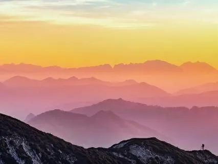
The Sandia Mountains are the predominant geographic feature visible in Albuquerque.
Sandia is Spanish for watermelon,
And is popularly believed to be a reference to the brilliant pink and green coloration of the mountains at sunset.
The pink is due to large exposures of granadierite cliffs,
And the green is due to large swaths of conifer forests.
However,
Robert Julian notes in The Place Names of New Mexico,
A most likely explanation is the one believed by the Sandia Pueblo Indians.
The Spaniards,
When they encountered the Pueblo in 1540,
Called it Sandia,
Because they thought the squash growing there were watermelons,
And the name Sandia soon was transferred to the mountains east of the Pueblo.
He also notes that the Sandia Pueblo Indians called the mountain Bien Muor,
Big Mountain.
Albuquerque lies at the northern edge of the Chihuahuan Desert,
Transitioning into the Colorado Plateau.
The Sandia Mountains represent the northern edge of the Arizona-New Mexico Mountains ecoregion.
The environments of Albuquerque include the Rio Grande Bosque,
Floodplain cottonwood forest,
Haired scrub,
And mesas that turn into the Sandia foothills in the east.
The Rio Grande's bosque has been significantly reduced and its natural flood cycle disrupted by dams built further upstream.
A corridor of bosques surrounding the river within the city has been preserved as Rio Grande Valley State Park.
A few remaining natural arroyos provide riparian habitat within the city,
Though natural arroyos draining into the Rio Grande have largely been replaced with concrete channels.
After a series of floods in the 1950s,
Passage of the Arroyo Flood Control Act of 1963 provided for the construction of a series of concrete diversion channels.
The network of channels was built by the Army Corps of Engineers during the 1960s and early 1970s.
Iconic urban wildlife includes the roadrunner,
Gunnison's prairie dog,
Coyote,
And New Mexico whiptail lizard.
The bosque is a popular destination for wildlife viewing,
With opportunities to see porcupines and sandhill cranes in the winter.
Cooper's hawks are common in city parks.
Iconic vegetation in town varies by the terrain and soil type,
And much of Albuquerque that includes the Rio Grande cottonwood,
Goodings and coyote willow,
Arizona walnut,
And alkalized secation in the bosque.
On the edges of the Rio Grande floodplain,
Some remaining New Mexico olive,
Screw bean mesquite,
And lead plant occur.
Tree cholla,
Various prickly pear and yucca,
Chameza,
And one-seed juniper occur in upland areas as part of a desert grassland plant community within a cover of arid grasses,
Including black grama and purple three-awn,
Mostly east of I-25 and above the west mesa's volcanic escarpment.
West of the Rio Grande but below the escarpment,
The mesa's sand scrub plant community includes sand sagebrush,
Broom dahlia,
Four-winged saltbush,
And sandy soil-adapted grasses including various dropseed and Indian ricegrass.
Some stands of mariola,
Beebrush,
Three-leaf sumac,
Little leaf sumac,
And black spine prickly pear grow along or near the volcanic escarpment.
The foothill open space at the eastern border of the city limits also features Sonoran scrub oak,
With gray oak and some Colorado pinyon trees in more mesic locations.
Desert willow is a native tree along some arroyos,
And they are now commonly planted throughout the city.
Western honey mesquite and netleaf hackberry occur in small numbers beyond developed areas,
As do remaining stands of creosote bush on the southern edge of the city.
Tumbleweeds are common weed in disturbed areas and are used by Albuquerque's Flood Control Authority to make an annual holiday snowman adjacent to their headquarters building near the Big Eye Interchange near the city's center.
Albuquerque is geographically divided into four unequal quadrants that are officially part of mailing addresses placed immediately after the street name.
They are Northeast N.
E.
,
Northwest N.
W.
,
Southeast S.
E.
,
And Southwest S.
W.
Albuquerque's official quadrant system uses Central Avenue for the North-South Division and the railroad tracks for the East-West Division.
I-25 and I-40 are also sometimes used informally to divide the city into quadrants.
The Northeast Quadrant has been experiencing a housing expansion since the late 1950s.
It abuts the base of the Sandia Mountains and contains portions of the Foothills neighborhoods which are significantly higher in elevation than the rest of the city.
Running from Central Avenue and the rail runner tracks to the Sandia Peak Aerial Tram,
This is the largest quadrant both geographically and by population.
Martinez Town,
The Maxwell Museum of Anthropology,
University of New Mexico,
The Uptown area,
Which includes three shopping malls,
Hoffman Town,
Journal Center,
Are all in this quadrant.
Some of the most affluent neighborhoods in the city are here,
Including High Desert,
Tannawin,
Sandia Heights,
And North Albuquerque Acres.
Parts of Sandia Heights and North Albuquerque Acres are outside the city limits proper.
A few houses in the farthest reach of this quadrant lie in the Cibola National Forest,
Just over the line into Sandoval County.
The Northwest quadrant contains historic Old Town Albuquerque,
Which dates to the 18th century,
As well as the Indian Pueblo Cultural Center.
The area has a mixture of commercial districts and low- to high-income neighborhoods.
Northwest Albuquerque includes the largest section of downtown,
Rio Grande Nature Center State Park,
And the Bosque Woodlands.
Petroglyph National Monument,
Double Eagle II Airport,
The Paradise Hills neighborhood,
Taylor Ranch,
And Cottonwood Mall.
This quadrant also contains the North Valley Settlement outside the city limits,
Which has some expensive homes and small ranches along the Rio Grande.
The city of Albuquerque engulfs the village of Los Ranchos de Albuquerque.
A small portion of the rapidly developing area on the west side of the river,
South of the petroglyphs,
Known as the West Mesa or West Side,
Consisting primarily of traditional residential subdivisions,
Also extends into this quadrant.
The city proper is bordered on the north by the North Valley,
The village of Corrales,
And the city of Rio Rancho.