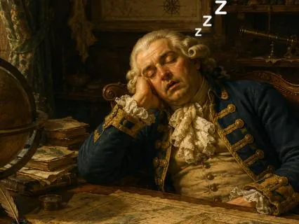
Hello my friend,
Welcome to humorously dull history for sleep.
My name is Stephen Dalton,
And it is my hope that as I tell you lots of different facts about particular periods in history tonight,
You find me so incredibly boring that you fall asleep very quickly,
And maybe even with a smile upon your face.
It is humorous history after all.
Tonight I'll tell you the humorously dull history of maps.
Yes.
Maps from a mammoth bone.
Carved with the local landscape 25,
000 years ago to a woman in 2007 in a Honda Civic being told by her phone to turn left into a canal.
So,
Just before we get started,
Allow yourself to settle into this moment.
Leave the day that was behind.
Feel the support.
Of whatever you lie upon.
If your eyes aren't closed yet.
Allow them to close.
Whatever has been.
Has been.
It's history now.
Whatever will be.
Whoopee.
All you have is this moment.
And my voice.
So allow your curiosity to be a part of this pleasant experience as I tell you the humorously dull history Maps.
Part one.
In which humans begin drawing the world.
Mostly incorrectly.
It is often assumed that map-making began with scholars wearing robes and using compasses but in truth.
It likely began with someone in a cave.
Trying to explain to someone else where the good hunting spot was.
Without resorting to interpretive pointing.
The earliest known example.
Sits in the Czech Republic.
A mammoth's bone.
Approximately 25,
000 years old.
Carved with what appears to be a river.
Pills.
And possibly seasonal camps.
Some archaeologists insist it is a map.
Others insist it might just be a doodle.
Is away.
It is inconveniently.
The oldest known attempt at spatial awareness engraved on animal remains.
Which sets the tone for cartography ever after.
Earnest.
Disputed?
And occasionally on bone.
Similar efforts appear in Spain's El Castillo cave.
And Francis Lascaux gave.
Were alongside elegant horses and bison.
There are lines.
Dots and shapes.
That some historians claim.
Represent rivers or stars.
No one can be entirely certain.
It could be a map of watering holes.
It could be an early board game.
Nonetheless.
It shows that before rising,
Before proper villages.
Humans were already attempting to explain locations to each other.
Using markings.
Rather than shouting.
Past the third tree that looks like a ghost.
This was,
In many ways,
The birth of maps,
And of being quietly annoyed that nobody else could read them properly.
By around six thousand years ago.
Map making became slightly less mysterious.
And slightly more rectangular.
In modern day Turkey.
At the sight of.
Cattle for you.
Archaeologists uncover it a war painting.
Believed to be a floor plan of the village.
Squares for houses.
A large rectangle interpreted as a volcano.
Or possibly just a poorly drawn hill.
This may be the world's oldest city map.
Residents probably admired it politely.
Before continuing to ignore it.
Around the same time.
In what is now China.
Evidence suggests that Neolithic peoples carved markings into tortoise shells and stone.
Possibly showing fields.
Road.
And clan boundaries.
These maps were not meant for navigation.
So much as for.
.
.
Clarifying who owned which bit of land.
And who had accidentally let their goats wander across it.
Meanwhile.
Far from the clay tablets of Mesopotamia.
Or the papyrus scrolls of Egypt.
Maps were also beginning in other corners of the world.
In Australia.
Aboriginal peoples carved route maps into rock.
And bar.
To illustrate pathways.
Water sources.
And sacred sites.
In the Pacific Islands.
Navigators wove stick charts from palm ribs and shells to represent ocean swells and island chains.
These charts were not meant to be read flat on a table,
But held in hand,
Or remembered entirely.
It is worth noting that almost none of these early maps looked like the world.
There were no neat north arrows.
No helpful scales.
And certainly no legends in the bottom corner.
Explaining what the squiggly line meant.
Most were more like memory aids.
Part Geography.
Part Storytelling part.
Arguing tool.
They were maps in the same way.
A shopping list is a novel.
Technically release it.
Vaguely helpful.
And likely to provoke discussion if interpreted too literally.
And so.
Map-making began not with empires,
But with small communities.
Uncertain drawings.
And a desperate need to explain where things were.
Without physically dragging someone there.
It was the dawn of cartography.
Just as importantly.
The dawn of someone standing beside an early map.
Saying.
No.
That's not a mountain.
That's my uncle's tent.
You're holding it upside down.
In the next part.
People begin to measure things more confidently.
And accuracy increases.
To nearly tolerable levels.
Part two.
In which civilizations begin measuring things.
And immediately disagree about everything.
With the arrival of settled life.
Came a new problem.
Once people stopped wondering and started owning things like Grain Goat.
And slightly lopsided houses.
They needed to know whose land was whose.
Thus,
Maps moved from cave walls and bones to slightly more dignified materials.
Such as clay,
Papyrus and bureaucratic irritation.
In ancient Mesopotamia.
Around 2300 BCE.
The Babylonian's Etched Map.
Into clay tablets.
Using cuneiform script.
One particularly famous tablet from Sipar Shows feel.
Canals.
And plots of land.
Neatly divided.
Like very early.
And rather dusty spreadsheet.
Historians believe.
It was used for taxation.
Or resolving arguments.
Both of which were likely extremely dull meetings.
Involving men with styluses and deep sighs.
Egypt.
Not wanting to be outdone.
In the art of organized land dispute.
Produced what is now considered.
The oldest known topographical map.
The Turin Papyrus map.
Circa 1150 BCE.
This hand-drawn scroll.
Cho's Road.
Pills.
And locations of quarries.
Used for mining precious stones.
All very impressive.
Until one realizes its main purpose.
Was to organize labor for mining expeditions.
It remains an incredible achievement.
In the field of paperwork.
The Egyptians also used maps.
To mark out farmland.
After the Nile's annual flood.
Inconveniently erased all the boundaries.
Leading to ancient surveyors.
Pacing around with ropes.
And a general air of resignation.
Where there is.
In ancient China.
During the Zhou Dynasty.
Around 1000 BCE.
Officials were busy carving maps into prongs.
And painting them on silk.
Chinese maps differed from Western ones.
By being far more practical.
And less concerned with abstract geography.
They focused on rivers,
Roads,
And administrative borders.
Not to glorify emperors.
But mainly to make sure taxes went to the right place.
By the 4th century BCE.
The Chinese were even using grid systems To measure and record land.
With alarming accuracy.
Grease,
Meanwhile.
Decided maps should be less about farming.
And more about philosophy.
In the 6th century BCE.
Anaximander of Miletus.
Drew what is often credited.
As the first.
Map of the entire world.
A very circular earth.
Surrounded by oceans.
And labels.
With only a few known continents.
It was wildly inaccurate.
But impressively confident.
Which made it extremely Greek.
Later thinkers like Esetius and Herodotus.
Refined these maps.
Although Herodotus mostly used them to explain why other people's countries were surprisingly far away.
And full of strange food.
Across the sea.
The Romans embraced maps for more practical reasons too.
Conquering things.
While they did not produce many maps that survived.
They built thousands of miles of road.
So straight.
You could use them as rulers and produce detailed itineraries like Tabula Putingeriana,
A long parchment that looks less like a map.
And more like someone tried to draw the entire empire on a napkin during lunch.
It showed roads.
Towns.
Rest stops.
And presumably places to buy sandals and wine.
Thus by the end of this era.
Maps had become tools of power.
Tray.
Taxation.
And gentle boasting.
They were still mostly wrong.
But now they were wrong with a sense of purpose.
The world was being measured.
Labelled.
And occasionally mislabeled.
With great enthusiasm.
Part 3 in which people draw the world.
Despite having seen almost none of it.
Once early civilizations had finished drawing their own fields and quarries,
They made a bolt.
And entirely unjustified leap.
They attempted to draw the entire world.
This was ambitious.
Considering most people never travelled more than a few kilometres from home.
And still got lost on the way back.
But that did not stop them.
From producing world maps.
With enormous confidence.
And minimal evidence.
Much like a child drawing a unicorn.
Because they once heard it mentioned.
The Babylonians gave us one of the earliest known world maps.
Around 600 BCE.
A small clay tablet showing Babylon in the centre.
Surrounded by a circular sea.
And beyond that.
Mysterious triangular regions labelled things like where no birds live.
It was less a useful guide.
And Morris Stateman.
Babylon is in the middle.
Everything else is dumb.
Far away.
And possibly full of monsters.
Other cultures saw this and thought,
We should do that too.
But with us in the middle instead.
The Greek.
Never once to resist a chance to be clever.
Produced maps that mixed geography with philosophical guesswork.
Esetius offered an earth shaped like a flat plate.
Herodotus politely disagreed and said the mapmakers were all wrong.
Though he didn't fix it either.
Then along came Anaximander.
Who drew the world as a circle surrounded by oceans.
It was still wrong.
But at least it looked neat.
Which counted for a loss in ancient cartography.
Over in India.
Maps looked very different and were tied to cosmology as much as geography.
Ancient Hindu and Jain texts.
Describe a vast world.
Made up of circular continents and seas,
Arranged like the layers of an onion.
With Mount Meru in the centre.
The sacred mountain at the axis of the universe.
Was it geographically accurate?
Was it spiritually satisfying and extremely symmetrical?
Absolutely.
Meanwhile in China.
.
.
Maps like the UG2 map of the tracks of U.
Carved into stone around 1137 CE.
Showed rivers,
Mountains,
And a grid system over the lung.
It was so detailed.
That one imagines government officials being quietly furious about it being carved in stone and not easily editable.
In medieval Europe.
Maps took an unexpected turn into theology.
The famous Mappa Mundi.
Weren't for navigation.
But for explaining God's layout choices.
Jerusalem sat at the centre.
East was at the top.
And most of Africa was a rumour.
These maps featured rivers,
Biblical scenes.
And occasionally a polite note.
Here be dragons.
Which is medieval for We have no idea.
Please don't ask.
They looked more like illustrated church posters than anything you'd want to travel with.
So.
.
.
By this point in history.
Maps weren't about accuracy.
They were about.
Authority.
Every map.
Quietly said the same thing.
Our town is the center of everything.
And beyond that.
Is ocean.
Miss?
And tremendous inconvenience.
Navigation was still mostly done.
By asking someone in the next village.
And hoping they weren't joking.
Part Four,
In which people start traveling further.
Get lost more impressively and invent the compass.
Out of sheer frustration.
For centuries.
Maps were mostly decorative arguments about where God was.
Barbalon or a large mountain belongs.
This was fine.
Until people started travelling seriously.
Across desert.
Along silk routes.
And most inconveniently,
Over giant stretches of water,
With no visible landmarks besides panicked as trade and exploration grew.
So did the number of people writing letters like this.
Dear family.
I remain at sea.
Please send instructions.
Cartographers.
Suddenly aware that their maps were being used by actual sailors.
Reluctantly decided to be slightly more accurate.
China,
As usual.
With several steps ahead.
And quiet about it.
By the 11th century.
They had invented.
The Magnetic Compass.
Originally used for arranging furniture according to harmony and good fortune,
Before someone realized it was also quite good at not dying at sea.
Chinese maritime maps soon included coastlines,
Currents,
Ports,
And polite warnings about pirates.
Meanwhile,
In Europe,
Sailors continued pointing at stars.
Squinting.
And hoping for the best.
Until the compass arrives.
And caused everyone to pretend.
They'd always known how it worked.
This new age of navigation.
Produced a very specific kind of map.
The Portolan Chart These emerged around the 13th century in Mediterranean ports like Genoa and Venice.
They were covered in intersecting lines called rum lines,
Coastlines and place names written diagonally for reasons no one has ever explained.
They were surprisingly accurate.
Mostly because they only bothered mapping the bits you could sail along.
And ignored the rest of the continent entirely.
Inland towns.
Simply didn't exist.
Unless they had a harbour.
A tavern,
Or a nice fish market.
At the same time.
The Islamic world was quietly drawing circles around the rest of us.
Scholars from Baghdad to Córdoba were refining Greek geography.
Calculating Earth's circumference more accurately.
Than anyone since Eratosthenes.
And producing world maps.
That didn't put their own house exactly in the centre.
Which,
Frankly,
Was extremely mature of them.
Al Idrisil's 1154 world map.
Commissioned in Sicily.
Showed Europe.
Asia.
And Africa.
Like one continuous landmass.
Unfortunately.
It was engraved on a silver disc.
That no one sought to photocopy.
Back in Europe,
Medieval monks continued painting maps.
That were spiritually meaningful.
And practically useless for finding anything except eternal judgment.
They labeled areas with comments like,
Here are dog-headed men,
Or land of darkness.
These were inspirational to theologians.
Bless so.
To sailors.
So.
By the end of this chapter.
Humanity had two types of maps.
One.
Useful ones.
Used by people who actually went places.
Too.
Beautifully incorrect ones.
Used by people.
You didn't.
Part Five In which people attempt to draw the world Using ropes,
Memory.
And occasional guesswork.
The problem with drawing the world.
Is that you have to know what the world looks like.
This is difficult.
When most people never travel further than the next village.
And those who do often come back with descriptions like,
It's sort of far and full of wind.
Early map-makers therefore relied.
On an awkward combination of Traveler's Tales.
Merchant's Sketches.
And sailors describing coastlines.
By waving their arms.
None of this was ideal for accuracy.
But excellent for producing maps filled with confident mistakes.
Land-based map-making began with the humble measuring rope.
Egyptian and Mesopotamian surveyors used knotted cords and wooden poles to measure fields,
Especially after floods wiped out boundaries.
In China.
They used grid systems and pacing.
Literally walking in straight lines while counting steps.
Then drawing whatever they hoped they'd walked past.
If terrain got rocky.
Or someone's goats were in the way.
They simply adjusted the map slightly.
And swore everyone to secrecy.
Later,
Medieval and early Renaissance mapmakers improved their tools slightly.
They used the astrolabe and quadrant.
To measure the angle of stars above the horizon.
Which helped determine latitude.
For distance.
They used dead reckoning.
Which involved writing down one,
Which direction they were going.
And two.
How fast they thought they were moving.
This was usually based on how much the ship creaked and whether the captain looked worried.
Unsurprisingly,
Many coastlines ended up longer or shorter.
Depending on who was steering.
And how honest they were feeling.
Information trickled back to map makers in port cities.
Venice.
Genoa.
Lisbon.
Where men sat in workshops.
Covered in chart fragments.
Ink stains.
And despair.
They interviewed sailors who disagreed about absolutely everything.
One claimed an island was three days west.
Another insisted it was two days south,
But filled with screaming birds.
The cartographer did the sensible thing.
He drew the island somewhere in between.
And added a few decorative sea monsters to distract from the uncertainty.
As exploration expanded,
So did methods.
Expeditions took sketch maps.
Drawn on board using compasses.
Sand glasses to count time and thus estimate speed.
And log lines.
Ropes thrown behind the ship with knots at regular intervals.
To measure distance by how many passed through a sailor's hands.
Before he complained about rope burns.
Back on land.
These sketches were combined with previous maps.
Gossip from traitors.
And a good imagination.
Overlapping information was considered reliable.
Solo reports from sailors who looked sunburned and nervous.
Retreated with caution.
By the late Middle Ages and early Renaissance.
Cartographers began adding latitude lines.
But longitude.
Remained a fantasy.
Without accurate clocks to tell time at sea.
Longitude was basically.
.
.
Where are we?
Somewhere between Portugal and shame.
Maps became denser.
Busier.
And marginally less disastrous.
The world was being stitched together.
From travellers feet.
Sailor's eyes.
And cartographer's patients.
Part six.
In which exploration booms.
New lands appear on maps.
And cartographers pretend they knew all along.
By the 15th century.
Maps went from gentle suggestions to bold claims.
Thanks to improved ships,
Compasses,
And a growing appetite for spices and bragging rights.
European Explorers.
Began sailing into the blank parts of maps The area is usually filled with dragons,
Sea serpents,
Or as a phrase.
Here be absolutely nothing.
Please turn back.
Unfortunately,
They did not turn back.
They returned with sketches.
Rumors.
And occasionally entire continents.
The big catalyst was the printing press,
Invented by Gutenberg around 1440.
Before this,
Maps were copied by hand,
Meaning each one was slightly different,
Occasionally upside down.
And always covered in someone's thumbprint.
With printing.
Suddenly you could mass-produce maps.
Mistakes included.
And send them across Europe.
A single error.
Such as placing Japan slightly north of Portugal.
Could now be confidently believed.
By thousands.
Then came Prince Henry the Navigator.
Who,
Despite the promising name,
Didn't actually navigate.
He sat in Portugal collecting sailors,
Map-makers,
Astronomers,
And anyone who could draw a reasonably straight coastline.
As expeditions went down the coast of Africa.
They returned with coastal charts and descriptions like There is love.
There are waves.
Please send more wine.
These were turned into maps.
Which were then locked in royal archives,
So rival nations wouldn't copy them.
Early cartography was,
Therefore,
30% science.
70% Government Secrets And one hundred percent seasickness.
The true earthquake came in 1492.
When Christopher Columbus attempted to reach Asia.
Miscalculated the size of Earth.
Bumped into the Caribbean.
And insisted it was India.
Cartographers to their credit.
Did not argue.
They simply drew a large new landmass.
Quietly labelled the residents as Indians.
Because adjusting labels was easier than adjusting Columbus.
A few years later,
Emerigo Vespucci suggested this was not Asia.
But an entirely new continent.
A German mapmaker named Martin Waldseemuller agreed and labeled it America.
On a world map.
In 1507.
Presumably because Vespucci Land.
Didn't fit nicely in the margin.
Meanwhile,
In the Islamic world and in China,
Map-making remained sophisticated.
But less loudly advertised.
In Beijing.
Meticulous maps of rivers,
Cities,
And administrative divisions were carved into stone steels.
In the Ottoman Empire.
Superior race.
Created maps showing parts of Europe,
Africa.
And the Americas.
On gazelle skin.
A good measure.
But Europeans largely ignored it,
As they did not agree with their mistakes.
By now,
The map of the world was expanding faster.
Than anyone could travel it.
Coastlines began to look like coastlines.
Islands were placed in roughly the correct oceans.
And sea monsters.
Gradually went extinct.
On paper at least.
But in land.
Still mostly imagination.
Mountains were drawn.
Wherever there was empty space.
And rivers flowed in whichever direction balanced the composition.
Part 7 in which maps become instruments of power.
Projection.
And petty national bragging.
By the 16th century.
Map-making was no longer a quiet art done by monks with ink-stained sleeves.
It had become political.
Kings and queens wanted maps,
Not just to show where things were.
But to prove that those things now belonged to them.
The map became a tool of empire.
A way of saying.
This land is ours.
Yes,
We've never been there.
But low.
It's in our color now.
Into this enthusiastic atmosphere,
Step by step.
Gerardus Mercator.
A serious-looking man from Flanders,
Who,
In 1569,
Created the most influential and confusing map.
In history.
The Mercator Projection.
His goal was simple.
Help sailors travel in straight lines using compass bearings.
His message.
Stretch the world vertically,
Like warm cheese pizza.
This made high-latitude countries like England and Denmark.
Look enormous and impressive.
While placed near the equator.
Like Africa.
Remained inconveniently accurate.
Europe was delighted.
Everyone else was somewhat smaller.
And less delighted.
Around the same time,
Explorers were sending home increasingly detailed but still wildly contradictory.
Report.
One sailor claimed Australia was full of giant hopping rats.
Another drew California as an island.
Rather than wait for confirmation,
Cartographers simply picked whichever version came with better handwriting.
This is our maps of the 1600s.
Ended up with Phantom Islands.
Misplaced mountains.
And rivers flowing optimistically through deserts where no rivers existed.
Or wanted to exist.
Map-making workshops became hives of pressure.
Cartographers sat surrounded by letters from explorers coastal sketches.
And government officials reminding them.
To make their nation's territory.
Slightly larger than the last edition.
Mistakes were quietly erased.
New coastlines inked in.
And if there was still blank space.
A sea monster was added for dignity.
Meanwhile.
.
.
The Portuguese and Spanish kept the best maps under literal lock and key.
Stored in royal Casa de la Contratación rooms,
Where map theft was punishable.
By something very serious involving chains.
In China.
During the Ming Dynasty.
Maps like the Da Ming Huni Tu attempted to show the entire known world.
China in the Middle.
Was Korea,
Japan.
In dear?
Persia?
And even Africa around it.
Not entirely accurate,
But impressively global for the time.
Meanwhile.
.
.
European maps rarely acknowledged China.
Unless they needed to decorate the edge of the paper.
It was a great age of exploration.
If you were European.
If you lived somewhere being explored.
It was less exciting and more Why are these people drawing my house?
By the end of this era.
Maps were no longer quiet guesses.
Their restatements.
Tools of navigation,
Yes.
But also tools of power.
Taxation.
Face.
Propaganda.
And petty international ego.
And yet.
They were still wrong.
Continents were lumpy.
Distances were guesses.
And Tasmania was still attached to Australia.
Like someone had glued it on with hope.
Part Eight.
In which science arrives.
Nobody enjoys it.
And the earth is measured out of spite.
By the 17th and 18th centuries.
People were growing suspicious of maps that featured both real coastlines and sea monsters.
Exploration was increasing.
Ships were no longer falling off the edges of the world.
And someone finally said.
.
.
What if we measured things properly?
This marked the beginning of scientific cartography.
Also known as men in wigs,
Carrying equipment up hills while regretting their life choices.
One of the first problems they attacked was longitude.
The great cartographic embarrassment.
Lazitude was easy.
You looked at the stars and said,
Yes.
This is definitely North-ish.
But longitude required knowing the precise time in two places at once.
Scientists tried everything.
Lunar distance charts.
Dead reckoning.
Even listening for cannon blasts across oceans.
But this did not work.
Eventually.
A carpenter named John Harrison.
Built the first accurate sea clock.
In the 1700s.
The Marine Chronometer.
Which kept time.
Even when the ship was rolling.
Leaking.
Or being attacked by mildly disappointed pirates.
With it.
Sailors could finally calculate.
Longitude.
And cartographers.
At fewer excuses.
Meanwhile,
In France,
A group of scientists were determined to prove the Earth's exact size and shape.
This layer.
To the Great Meridian Expedition.
Which can best be described.
As several men.
Dragging measuring sticks.
Telescopes.
And pure resentment.
Across mountains from Dunkirk to Barcelona.
They measured one degree of Earth's meridian.
Using triangles.
Stars.
And a deep mistrust of clouds.
It took seven years.
A few arguments.
Several illnesses.
And at least one mule-related incident.
The result.
The earth was slightly squashy.
Wider at the equator than at the poles.
Everyone nodded politely,
Then immediately argued about it anyway.
The British,
Not to be outdone,
Launched the Ordnance Survey,
An effort to map Britain with such detail that invaders would be too bored to attack.
Teams used triangulation.
Climbing hills.
Placing enormous wooden markers.
And measuring angles between them.
Wiz.
See your delights.
These were essentially telescopes on tripods.
Held by cold men in wind.
The work was so meticulous.
That a single incorrectly measured church spark could ruin an entire region's map.
And ruin several tempers.
Around the world,
Similar mapping projects appeared.
In India,
The great trigonometrical survey began in 1802.
And lasted 70 years.
Surveyor's Mark thousands of miles.
With heavy instruments.
Measuring from peak calculating the height of the Himalayas.
And occasionally receiving unwanted attention from tigers.
This is when they identified.
The tallest peak in the world.
Which they call Speak 15.
Because no one had the energy for poetry.
It was later renamed.
Mount Everest.
After a surveyor who never actually saw it.
Probably preferred a quiet desk job.
Bye now.
Mapping had become a mixture of astronomy,
Mathematics?
And exhaustion.
Stars were catalogued.
Coastlines redrawn.
And inland areas.
Measured by teams with rulers.
Longer than some European countries had kings.
The sea monsters vanished from maps.
Replaced by something even scarier.
Accurate distance scales.
Part nine.
In which the whole world finally gets mapped.
And immediately.
Everyone starts arguing about it.
By the 19th century.
The world was running out of blank spaces.
This was deeply upsetting to explorers.
You preferred wide,
Empty areas.
Labelled unknown.
To justify funding and large hats.
Thanks to accurate clocks.
Triangulation.
And an alarming number of exhausted surveyors.
Coastlines.
Were now mostly correct.
The age of Guess where Asia is?
Was ending.
Unfortunately,
A new era began.
Argument over who owns it.
Colonial Empires.
Used maps as legal documents.
Drawing borders on places they'd never visited.
And labelling them things like French West Africa.
British India.
Probably Spain's.
We haven't checked yet.
Lines were drawn at conference tables with rulers.
Cigars.
And absolutely no consultation with the people who already lived there.
This created nations.
Disputes.
And at least three future wars because someone drew a border through a village A river and one man's goat.
For the first time,
We get world atlases meant for the public.
Companies like Rand McNally Stylus Atlas and John Bartholomew and Sons.
Mass-produced maps.
For schools.
Libraries.
And anyone who needed accurate proof.
That Scotland is not in fact a country.
Halfway down England.
These atlases proudly declared.
This is what the earth looks like.
Schools proudly replied.
Wonderful.
We shall never update these again.
Meanwhile.
.
.
Arguments broke out.
Over which projection was the correct one.
Mercator made Greenland the size of Africa.
The Peter's projection.
Made it look like someone squished earth in a mango.
The Robinson Projection tried to please everyone,
And pleased absolutely no one.
Geography teachers sighed.
Rolled down their warm-ups.
And prayed the class wouldn't ask questions.
About why Australia.
Looks like soggy bread.
Scientific mapping also flourished.
The United States Geological Survey.
Began mapping the US in astonishing detail.
The British Ordnance Survey.
Having finished Britain.
Continued mapping Ireland,
India,
And any territory unfortunate enough to be colonised Germany stitched railways across new maps.
Russia.
Drew maps so large.
They needed tables the size of small barns.
Every nation insisted their mups.
Were the most accurate.
Especially when they weren't.
And yet.
.
.
Not everything was colonial land-grabbing and long rulers.
In the Pacific.
Polynesian navigators continued using stick charts.
Lightweight frameworks of curved palm ribs and shells representing winds.
Currents.
Island positions.
Perfectly accurate.
And completely baffling to European admirals.
In Australia.
Aboriginal song lines.
Mapped the landscape through memory.
Rhythm and story.
You sang the land to navigate it,
Knowing.
No paper.
No mistakes.
By the late 1800s,
The world was almost fully drawn.
The white bits had disappeared.
The sea monsters were gone.
What remained were empire colors,
Rail lines,
Contour marks.
And a quiet sense that humans had finally organised the planet.
At least on paper.
Part 10.
In which humans finally see the world from above.
And immediately start zooming in.
By the early 20th century,
Mapmakers had walked,
Measured,
And argued their way across most of the globe.
Just when they thought they could rest.
Someone invented the aeroplane.
Suddenly.
Instead of climbing hills for a better view of a valley.
You could hover above it.
In a noisy machine.
While holding on to your hash and a pencil.
Aerial photography changed everything.
During World War I.
Cameras were strapped to planes.
And pilots were told.
To fly in straight lines while being shot at.
Which was not ideal.
But did produce excellent topographical data.
After that.
.
.
Large-scale land surveys became faster.
Photographs were stitched together to make accurate maps,
Though sometimes church spires still looked suspiciously tilted,
And sheep occasionally appeared in lakes due to poor alignment.
By World War II.
Aerial mapping had become a crucial military tool.
Soldiers marched into battle.
Holding fold-out maps.
That claimed the village was to the left.
Often.
It was not.
Then came the age of satellites.
In 1972.
NASA alone.
LANDSAT 1 the first satellite to photograph Earth continuously from space.
This made it incredibly difficult.
For cartographers to pretend.
That certain coastlines were wobbly on purpose.
Certainly.
Maps could be updated using real data.
Measurable data.
Instead of rumour.
Goat or vague memory.
Mapmakers everywhere,
Sighed.
And threw their sea monsters in the bin.
Meanwhile.
.
.
An invention called GPS.
Or global positioning system appeared.
A network of satellites that could tell you where you were on earth within a few meters.
Originally built by the US military,
It eventually became available to civilians.
Hikers rejoiced.
Sailors rejoiced.
Orienteering clubs.
Soap.
Asking for directions.
Became optional.
Rather than mandatory.
Then came the final revolution.
Google Maps in 2005.
No more unfolding paper maps the size of tablecloths in car parks.
Now anyone could type.
Bakery near me.
And be guided there by a calm digital voice that occasionally directed them into rivers.
People zoomed in on their own houses.
Than everyone else's houses.
Then strange parts of the world.
That they had no intention of visiting.
For the first time in history.
The average person.
At more geographical power.
Than most emperors.
Today maps are everywhere.
On phones watches.
Dashboards.
They update themselves while you sleep.
They showed traffic.
Bicycle routes.
Population density.
Even how flat or hilly your walk will be.
And yet.
.
.
The purpose remains oddly similar to when someone scratched a mammoth bone 25,
000 years ago.
To answer the timeless question.
Where am I?
And how do I get there?
To where the food is.
Part 11.
In which we arrive.
More or less.
At the right place.
And so.
.
.
After bones.
Clay tablets.
Sea Monsters.
Globe.
Telescopes.
Chronometers.
Satellites.
And one or two international incidents involving rulers and cigars.
We come to the end of our journey.
Through map making.
The world is now mapped in astonishing detail.
Every street.
Ew.
Bus stop.
And mildly disappointing cafe.
Can be located in seconds.
And yet.
.
.
Ironically.
Humans have never been more capable of getting lost.
While staring directly at a map.
Maps were never just about geography.
They have always been.
About certainty.
Or at least the illusion of it.
The first map scratched on a cave wall said,
The food is here.
Which is essentially the same thing your phone says today when you type nearest supermarket Mups helped farmers argue less.
Armies conquer more.
And empires color in places they couldn't pronounce.
They have been wholly political.
Wildly inaccurate.
Beautifully artistic.
Occasionally tea-stained.
And frequently upside down.
Even now.
In an age where satellites watch your car reverse out of the driveway.
Maps are still imperfect.
Borders are disputed.
Names change depending on who you ask.
Some countries appear larger or smaller.
Depending on who drew the projection.
Digital maps suggest roads that don't exist.
Footpaths that stop abruptly in fields.
And cafes that closed in 2014.
The mistakes remain.
Only smaller.
And more pixelated.
But for all their flaws.
Maps do something quietly remarkable.
They make the world.
Knowable.
They reassure us.
That the vastness around us as edges.
Shapes.
Contours.
And a place where we belong.
Whether it's a medieval monk drawing paradise above Jerusalem.
A Chinese scholar.
Carving rivers into stone.
Or a traveler today,
Dragging two fingers to zoom out.
And check where the mountains are It's the same impulse.
To see beyond the hill.
To understand what lies past the water.
To not fear.
Entirely lost.
The Story of Mops really end.
It just keeps updating.
Recalculating.
As your Sat Nav would say.
One survey.
One satellite.
And one impatient make a U-turn at a time.