Welcome to the I Can't Sleep Podcast,
Where I help you drift off one fact at a time.
I'm your host,
Benjamin Boster,
And today's episode is about the Great Bear Rainforest.
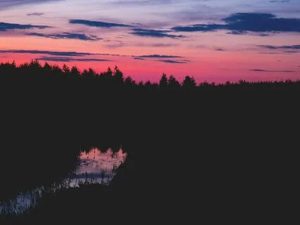
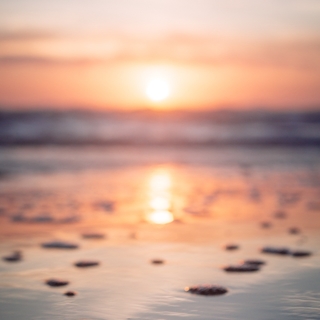
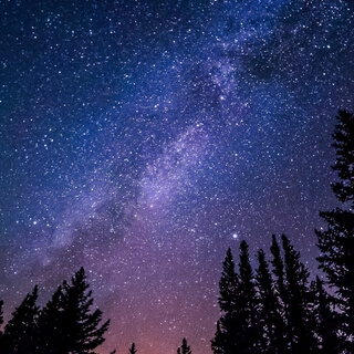
The Great Bear Rainforest is a temperate rainforest on the Pacific coast of British Columbia,
Comprising 6.
4 million hectares.
It is part of the larger Pacific temperate rainforest ecoregion,
Which is the largest coastal temperate rainforest in the world.
The Great Bear Rainforest was officially recognized by the Government of British Columbia in February 2016,
When it announced an agreement to permanently protect 85% of the old-growth forested area from industrial logging.
The forest was admitted to the Queen's Commonwealth Canopy in September of the same year.
The size of the Great Bear Rainforest,
Also called the North and Central Coast Land Use Planning Area,
Or the Central and North Coast LRMP Area,
Is roughly 32,
000 square kilometers.
As part of the 2006 North and Central Coast Land Use decision,
Three new land use zones were created.
Protected Areas,
Biodiversity,
Mining,
And Tourism Areas,
BMTAs,
And Ecosystem-Based Management Operating Areas,
EBMs.
As of 2009,
Approximately 16,
000 square kilometers of the region has been designated as protected areas,
In form called conservancies,
And 3,
000 square kilometers as BMTAs.
Commercial timber harvesting and commercial hydroelectric power projects are prohibited within BMTAs.
The Great Bear Rainforest extends from the Discovery Islands in the south to the BC-Alaska boundary in the north.
It includes all offshore islands within this range,
Except Vancouver Island and the archipelago of Haida Gwaii.
Its northern end reaches up Portland Canal to the vicinity of Stewart.
To the south it includes Prince Rupert,
Most of Douglas Channel,
Half of Hawkesbury Island,
And part of Gardiner Canal.
Kitimat is outside the region to the east.
Farther south,
The region includes all of the coast,
West,
And south of the Fjordland Conservancy,
Kitlopi Heritage Conservancy Protected Area,
Tweedsmere North,
And Tweedsmere South Provincial Parks,
Which includes Dean Channel,
Burke Channel,
Rivers Inlet,
And the communities of Bella Bella,
Bella Coola,
And Higginsborg.
The southern end of the region includes Knight Inlet and Butte Inlet.
The Great Bear Rainforest is one of the largest remaining tracts of unspoiled temperate rainforest left in the world.
The area is home to species such as cougars,
Wolves,
Salmon,
Grizzly bears,
And the Kermode Spirit Bear,
A unique subspecies of the black bear,
In which one in ten cubs displays a recessive white-colored coat.
The forest features 1,
000-year-old western red cedar and 90-meter-tall Sitka spruce.
Coastal temperate rainforests are characterized by their proximity to both ocean and mountains.
Abundant rainfall results when the atmospheric flow of moist air off the ocean collides with mountain ranges.
Much of the Pacific coastline of North America shares this climate pattern,
Including portions of Alaska,
British Columbia,
Washington,
Oregon,
And Northern California.
The temperate rainforests of the central and north coast of mainland BC were largely unknown to conservationists as late as the 1980s.
Then,
In 1990,
Peter McAllister,
An ex-chair of the Sierra Club of Western Canada,
Veteran forest campaigner Carmen Awalbrun,
Provincial Park,
And early advocate for boycotts against the timber industry,
Chartered a three-masted ship skippered by an Arctic adventurer,
Captain Sven Johansson.
With a crew of friends aboard the North Star of Herschel Island,
McAllister sailed north from Victoria that summer to launch what would become known as the Great Bear Rainforest Campaign.
It was the first of a series of exploration voyages to the central and north coast of British Columbia to support the First Nations of the central and north coast in taking back their traditional territories from the timber companies,
Protecting the remaining unlogged watersheds,
And bringing recognition to the ecological and cultural values of a significant expanse of the earth's temperate rainforest.
Organizing themselves as the Raincoast Conservation Society,
They alone conducted the Great Bear Rainforest Campaign until 1996,
When some of the environmental organizations involved in Clarequod Sound on Vancouver Island turned their attention to the Great Bear.
The Society's expedition voyages took on board an international array of journalists,
Filmmakers,
Photographers,
Scientists,
And conservationists.
The first order of business was to make contact with the Hale-Stoke First Nation in Bella Bella,
The fishing village in the heart of the Great Bear.
On the inaugural expedition,
They learned that the Macmillan Bloattle was poised to log the Quay River watershed.
Having salmon runs and a healthy grizzly population,
The Quay,
Together with the adjacent Namu River watershed,
Is one of the largest complexes of ancient forests of the central coast.
On returning to Victoria,
MacAllister presented the Quay River Watershed Wilderness Proposal,
Which convinced the social credit government to set aside the Quay watershed from logging in 1991.
The second exploratory expedition was aboard the sloop of Baden Cross,
A founding director of their Great Bear campaign organization,
The Raincoast Conservation Society.
In Bella Bella,
On the third expedition in 1993,
Was the commencement of a long-term interaction with chiefs,
Elders,
And concerned teenagers of the Hale-Stoke First Nation regarding the conservation of their traditional territory on the central coast.
Commencing with the third expedition in 1993,
Peter's family,
Including Ian MacAllister,
Karen MacAllister,
And Bernadette Mertens MacAllister,
Became team members.
In 1994,
Ian and Karen MacAllister sailed their catamaran,
Halibut,
From Ottawa through the Panama Canal,
To join the Raincoast expeditions.
Their photography helped illuminate the Great Bear internationally.
In the first five years of the campaign,
Thousands of kilometers of ragged coastline and fjords were sailed all the way to the Alaskan border,
The full extent of the Great Bear.
Mike Humphries,
A Second World War fighter pilot,
Flew aerial reconnaissance,
Enhancing the documentation of logging operations,
While offering a bird's-eye view of the landscape of the Great Bear.
Stories of these first years of the campaign were presented in slideshows in Western North America and Europe,
While those on board spread the word in newspapers,
Articles,
Journals,
And magazines.
Documentaries brought international condemnation and the cancellation of contracts with pulp and paper producers.
Battle for the trees.
In 1994,
Sierra,
The magazine of the Sierra Club,
Said,
Magazine wants no part of B.
C.
Pulp.
Excerpts from the documentary Legacy,
Killing a Temperate Rainforest,
Depicting decluttering,
Were picked up by CNN and PBS.
Jep Weber,
MP of Luxembourg,
A leader of the Greens,
And the European critic on logging practices,
Invited Peter McAllister to the European Parliament in Strasbourg to present evidence of the clear-cutting of old-growth forests in coastal British Columbia,
Countering decades of denials by the provincial government and the timber industry.
Evolution of the name Great Bear Rainforest.
First,
It was publicized at the Hidden Coast and the Rain Coast.
In 1993 was the launching of their flagship organization,
The Rain Coast Conservation Society.
Expeditions became known as Rain Coast Expeditions.
That year,
Peter McAllister first used the Great Bear name in honor of the coastal grizzlies fishing the Salmon Rivers.
Great Bear Wilderness made its appearance in a 1994 Rain Coast Conservation Society publication.
In 1996,
He and McAllister added Rainforest to the Great Bear name when the Rain Coast Conservation Society met with Rainforest Action Network in San Francisco to develop their international market campaign strategy.
In 1996,
Rain Coast's aerial reconnaissance photography of logging operations in the Great Bear was used by Rainforest Action Network in San Francisco to begin developing an international marketing campaign.
Home building suppliers inspired by the evidence threatened logging companies operating in Heiltsuk territory with boycotts.
This helped force the provincial government and the timber industry to come to the table for the beginning of negotiations involving the protection of the Great Bear Rainforest.
In May 2004,
The stakeholders agreed to recommend the B.
C.
Government that about 14,
000 square kilometers,
About 33% of the Great Bear Rainforest,
Be put under some form of protection and that new forms of ecosystem-based forestry be required throughout the rainforest.
This fell short of the activists' recommendations which had concluded that 44% to 70% should be protected.
The recommendation given to the B.
C.
Government was a compromise agreed to by the stakeholders after negotiations.
The stakeholders included provincial and local governments,
Many B.
C.
First Nations such as the Heiltsuk and Homalko,
The E.
N.
G.
O.
's Greenpeace,
Forest Essex,
Rainforest Action Network,
Pacific Wild,
And Sierra Club B.
C.
And forestry corporations such as Canadian Forest Products,
Catalyst Paper Corporation,
International Forest Products,
Western Forest Products,
And many others.
On the 7th of February 2006,
A comprehensive protection package was announced for the Great Bear Rainforest which was defined to include the central and north coasts of B.
C.
And Haida Gwaii.
The Great Bear Rainforest Agreement included four key elements,
Rainforest protection,
Improved logging practices,
The involvement of First Nations in decision-making,
And conservation financing to enable economic diversification.
The final agreement banned logging in 33% of the Great Bear Rainforest and implemented ecosystem-based forestry management for the entire Great Bear Rainforest by 2009.
In 2006,
Agreement between the B.
C.
Government and a coalition of conservationists,
Loggers,
Hunters,
And First Nations established a series of conservancies stretching 400 kilometers along the coast.
The proposed protected areas will contain 18,
000 square kilometers and another 46,
900 square kilometers that is to be run under a management plan that is expected to ensure sustainable forest management.
The Canadian government announced on the 21st of January 2007 that it would spend $30 million for protection of this rainforest.
This matched a pledge made previously by the British Columbia government as well as private donations of $60 million making the total funding for the new reserve $120 million.
In autumn 2008,
Greenpeace,
Sierra Club B.
C.
,
And Forest Ethics,
Jointly known as Rainforest Solutions Project,
Launched an online campaign titled Keep the Promise to put pressure on Gordon Campbell,
Then Premier of British Columbia,
To honor the Great Bear Rainforest Agreement.
The groups were concerned about certain aspects of the agreement including implementation of ecosystem-based management would not materialize in time for the government's own final implementation deadline of March 31st,
2009.
Premier Christy Clark announced on February 1st,
2016 that an agreement had been reached between the government of British Columbia,
First Nations,
Environmentalists,
And the forestry industry to protect 85% of the 6.
4 million hectare Great Bear Rainforest from industrial logging.
The remaining 15% would still be subject to logging under stringent conditions.
The agreement also recognizes Aboriginal rights to shared decision making and provides a greater economic share of timber rights and $15 million in funding to 26 First Nations in the area.
The Great Bear Rainforest Act was introduced by Cabinet on March 1st,
2016.
In September,
Prince William,
Duke of Cambridge,
And Catherine,
Duchess of Cambridge,
Visited and unveiled a plaque in the forest acknowledging its admission into the Queen's Commonwealth Canopy.
The British Columbia Coast,
Popularly referred to as the BC Coast or simply the Coast,
Is a geographic region of the Canadian province of British Columbia.
As the entire western continental coastline of Canada along the Pacific Ocean is in the province,
It is synonymous with being the West Coast of Canada.
While the exact boundaries are variously defined,
The region is generally defined to include the 15 regional districts that have coastline along the Pacific Ocean or Salish Sea or are part of the Lower Mainland,
A sub-region of the British Columbia Coast.
Other boundaries may exclude parts or even entire regional districts such as those of the aforementioned Lower Mainland.
British Columbia Coast While the term British Columbia Coast has been recorded from the earliest period of non-native settlement in British Columbia,
It has never been officially defined in legal terms.
The term has historically been in popular usage for over a century to describe a region of the province that extends west from the Coast Mountains and North Cascades.
This definition makes the term British Columbia Coast largely synonymous with the 15 regional districts that have territory in this region.
Vancouver Island Among locals,
The British Columbia Coast can further be divided into seven major sub-regions.
Vancouver Island includes Vancouver Island,
The Gulf Islands,
And sometimes Quadra Island.
Lower Mainland includes Greater Vancouver,
Fraser Valley,
And sometimes the Sea to Sky Corridor.
Sunshine Coast includes the Islands and Mainland Coast between Howe Sound and Desolation Sound.
South Coast includes the Lower Mainland and Sunshine Coast but excludes Vancouver Island.
This sub-region is closely associated with the Salish Sea.
Central Coast includes the Islands and Mainland Coast between Desolation Sound and Cape Caution.
This sub-region is sparsely populated and is represented by the regional districts of Strascona and Mount Waddington.
The northern limit of this sub-region is often extended northward to the Don Peninsula to include Central Coast Regional District.
North Coast includes the Islands and Mainland Coast between Cape Caution and Portland Canal.
This sub-region is represented by the regional districts of Central Coast,
Kitimatstikine,
And North Coast.
This sub-region is closely associated with the Great Bear Rainforest.
Haida Gwaii includes the Haida Gwaii Archipelago,
Which is located about 90 kilometers west of the mainland north coast.
Research from the 1990s has indicated that the Ice Age era coastline of the British Columbia Coast was lower by about 100 meters.
The effect of the sea level on the coastline was such that Queen Charlotte Sound,
Which is between Haida Gwaii and the northern end of Vancouver Island,
Was a coastal plain,
As were all the straits inland from it,
Except for those that were mountain valleys.
Underwater archaeology has shown the presence of permanent human habitations and other activity at the 100-meter contour,
And the Ice Age extinction of such a coastal plain has put a new light on Ice Age populations in North America,
As well as on the strong likelihood of this area having been the major migration route from,
And perhaps to,
Asia.
The heavy indentation and mild climate of the British Columbia Coast have led to inevitable comparisons with the geography's predisposition to encouraging increased human settlement and movement,
As well as cultural foment and population growth in the Aegean,
The Irish Sea,
Hebrides,
And in the Danish Archipelago and adjoining Scandinavian coasts.
The natural fecundity of the environment,
Rich in seafood,
Wild game,
And greenery,
Combined with the ease of travel by water,
Has seen in all cases British Columbia,
Denmark,
Greece,
To have generated a dynamic and gifted civilization.
And there are comparisons to be made between the artistic and political and social level of the Pacific Northwest peoples and those of pre-conversion pagan Scandinavia,
Ireland,
And archaic era Greece.
The British Columbia Coast stretches from the southern tip of Vancouver Island,
Along the Strait of Juan de Fuca,
To the unincorporated community of Stewart,
At the head of Portland Canal.
The aerial distance between these two points is approximately 945 kilometers.
However,
Due to its deeply incised coastline,
And over 40,
000 islands of varying sizes,
The total length of the British Columbia Coast is over 25,
725 kilometers,
Or approximately 10% of the entire Canadian coastline.
This coastal geography is shared with the neighboring U.
S.
States of Alaska,
And Washington.
The dominant landforms are the insular mountains of Vancouver Island,
And Haida Gwaii,
And the coast mountains that stretch along the entire length of the coast.
The proximity of these mountains to the coast produce fjords that rival those of Norway in length and depth.
Several large islands fill the strait between Vancouver Island and the mainland,
With Texada Island,
Cortez Island,
And Salt Spring Island being the largest in size.
Fjords of note include Burrard Inlet,
Burke Channel,
Howe Sound,
Jervis Inlet,
Desolation Sound,
Dean Channel,
Douglas Channel,
And Portland Inlet.
The BC coast is dominated by a moderate oceanic climate,
With warm summers,
Cool winters,
And constant rainfall that peaks during the winter months.
These areas enjoy the mildest winter weather in all of Canada,
As temperatures rarely fall below freezing.
The southernmost region of the coast,
Surrounding the Salish Sea,
Features a warm summer Mediterranean climate,
With warm,
Dry summers,
And cool,
Wet winters.
This gradually transitions to a predominantly oceanic climate in the north,
Along the coast and further inland into the foothills of the Pacific Ranges.
Higher elevations feature a sub-bolar oceanic climate,
With cool summers,
Cold winters,
And constant rainfall that peaks during the winter months.
The highest elevations feature a sub-arctic climate.
The British Columbia coast is dominated by temperate rainforest.
According to the Eco-Region System used by the World Wide Fund of Nature,
WWF,
The BC coast is part of five distinct ecoregions.
Puget Lowland Forests,
Central Pacific Coastal Forests,
British Columbia Mainland Coastal Forests,
Haida Gwaii Coastal Forests,
And Pacific Coastal Mountain Icefields and Tundra.
According to the Eco-Zone System used by Environment and Climate Change Canada,
The BC coast is part of four distinct ecozones.
Pacific Coastal Mountains,
Coastal Western Hemlock Sitka Spruce Forests,
Pacific and Nass Ranges,
And Strait of Georgia Puget Lowland.
According to the British Columbia Ministry of Forests,
Which uses an ecosystem classification system independent of the WWF and ECCC,
The BC coast is part of two distinct biogeoclimatic zones,
Coastal Western Hemlock and Coastal Douglas Fir.
The fishery of the Pacific Northwest Coast is legendary,
Especially for its many salmon runs and the cultures that built on top of them throughout the region.
Salmon runs have greatly diminished since pre-contact years and the advent of commercial canning and ultimately depletion of stocks by high seas fishing.
Other commercial fisheries include halibut,
Herring,
And herring roe,
Sea urchin,
And other specialty sushis,
Hake,
Haddock,
Cod,
Crab,
And shellfish.
The coast region of BC is connected to the rest of BC by various roads,
Depending on the region.
The populous Fraser Valley and Lower Mainland is linked to the rest of the province by Highway 1,
Highway 5,
Highway 3,
And Highway 99.
The Lower Mainland is also connected to the U.
S.
By four highway border crossings,
With the Peace Arch on Interstate 5 being the largest.
Several freeways connect lower mainland communities together.
The backbone of Vancouver Island's highway network is the Highway 19,
Which along with a portion of Highway 1,
Forms the Island Highway.
The Island Highway is a mix of four-lane freeway,
Four-lane arterial highway,
And two-lane highway running roughly along the east shore of Vancouver Island.
Access to the west coast of Vancouver Island can be accomplished by crossing mountain passes on Highway 4 to Tofino,
And Highway 28 to Gold River.
Thousands of other roads ranging from small freeways near Victoria to logging roads exist all over the island.
Although the Sunshine Coast is on the mainland,
It is connected to the highway network only by ferries.
It has one route,
Which is Highway 101,
A narrow,
Curvy,
Two-lane road split into two by a ferry crossing.
Texada Island,
A large island off the Sunshine Coast,
And has its own network of highway standard roads,
Although they are unnumbered.
Owing to the challenging topography of the British Columbia Coast,
There is no north-south highway linking the coastal communities of the province between Port Hardy and Kitimat.
Instead,
Travelers utilize one of the coastal ferry lines operated by BC Ferries.
The exceptions are,
Bellacoola is accessible by a long,
Largely gravel Highway 20 from the BC interior over a high pass,
And the towns of Terrace,
Prince Rupert,
And Kitimat,
Which is assessed from the BC interior on Highway 16.
Haida Gwaii is an extension of Highway 16 on it.
One of Haida Gwaii's few paved roads.
The sheltered waterways of the British Columbia Coast form part of the Inside Passage,
A coastal maritime route along which vessels navigate to avoid the rough waters and bad weather of the open North Pacific.
As such,
The maritime route is heavily trafficked by cruise ships,
Cargo ships,
Ferries,
And other marine vessels.
BC Ferries,
An independently managed,
Publicly owned company,
Operates scheduled daily crossings between major population centers throughout the British Columbia Coast.
Dozens of smaller ferries ply lesser routes within and between these regions.
The Alaska Marine Highway also operates non-stop ferry service through the British Columbia Coast along its Bellingham-Ketchikan route.
The Port of Vancouver is the largest commercial shipping port in all of Canada,
And along the entire Pacific Ocean,
Pacific Coast of North America,
By metric tons.
Which handles a total cargo volume of 76.
5 million metric tons.
By the same metric,
The Port of Vancouver is also the fifth largest commercial shipping port in North America.
The Port of Prince Rupert possesses the deepest ice-free natural harbor in North America,
And the third deepest natural harbor in the world.
Situated at 54 degrees north,
The harbor is in the northwestern-most port in North America linked to the continent's railway network.
The port is the first inbound and last outbound port of call for some cargo ships traveling between eastern Asia and western North America,
Since it is the closest North American port to key Asian destinations.