Welcome to the I Can't Sleep podcast,
Where I help you drift off one fact at a time.
I'm your host,
Benjamin Boster,
And today's episode is about geoglyphs.
A geoglyph is a large design or motif,
Generally longer than 4 meters,
Produced on the ground by durable elements of the landscape.
Such as stones,
Stone fragments,
Gravel,
Or earth.
A positive geoglyph is formed by the arrangement and alignment of materials on the ground,
In a manner akin to petroforms,
While a negative geoglyph is formed by removing part of the natural ground surface to create differently colored or textured ground in a manner akin to petroglyphs.
Geoglyphs are generally a type of land art,
And sometimes rock art.
A hill figure is created on a slope so that it can be seen from a distance.
Arguably the most famous geoglyphs are the Nazca lines in Peru.
The cultural significance of these geoglyphs,
For their creators,
Remains unclear,
Despite many hypotheses.
Since the 1970s,
Numerous geoglyphs have been discovered on deforested land in the Amazon rainforest,
Brazil,
Leading to claims about pre-Columbian civilizations.
Juan de Mar Díaz is accredited with first discovering the geoglyphs in 1977,
And Alciurranci with furthering the discovery after flying over Acre.
Other areas with geoglyphs include Megaliths in the Urals,
South Australia,
Mareiman,
Which is not ancient,
But rather a modern work of art with mysterious origins.
Western Australia and parts of the Great Basin Desert in the southwestern United States.
Hill figures,
Turf mazes,
And the stone-lined labyrinths of Scandinavia,
Iceland,
Lapland,
And the former Soviet Union are types of geoglyphs.
The south of England has a number of equine and human figures cut into chalk hillsides.
Examples include the Uffington White Horse,
Cern Abbas Giant,
Westbury White Horse,
And the Long Man of Wilmington.
Some are ancient,
Others from the last few centuries.
The works of the Old Men in Arabia,
Stone-built structures that are far more numerous than the Nazca Lines,
Far more extensive in the area than they cover,
And far older,
Have been described as geoglyphs by Emilia Sparovigna,
A physics professor at Politecnico di Torino in Italy.
The use of this term to describe these features is probably inaccurate,
As recent research has shown that most were not constructed primarily as art,
But were rather built to serve a range of purposes,
Including burial sites and funerary customs,
Aiding in the trapping of migratory animals,
And as cleared areas for camps,
Houses,
And animal enclosures.
Not all geoglyphs are ancient.
The land art movement created many new geoglyphs,
As well as other structures.
Perhaps the most famous example is Spiral Jetty by Robert Smithson.
Many towns and cities in the western United States use hillside letters,
Also known as mountain monograms,
On the hills above their locations.
Contemporary Australian sculptor Andrew Rogers has created geoglyphs around the world called the Rhythms of Life.
Yu Yang's regional park is the home of a geoglyph constructed by Rogers in recognition of the indigenous people of the area.
It depicts Bunjil,
A mythical creature in the culture of the local Wathrong Aboriginal people.
Geoglyphic texts and images are common in Central and Inner Asia,
But there has been little systematic study of their origins and spread.
More recent figures in the south of England,
Created since the early 1800s,
Have kept up the region's ancient tradition of chalk hillside figures.
Examples of these are the Littlington White Horse,
Devizes White Horse,
Cherhill White Horse,
And the Marlborough White Horse.
In 2008 to 2009,
Alfie Denon created BritGlyph,
A locative art-focused geoglyph created by having participants across the United Kingdom leave rocks at highly specific locations and uploading media created at each location.
When taken together and viewed in the main project website,
An image of a watch and chain inspired by John Harrison's marine chronometer H5 was created.
A petroglyph is an image created by removing part of a rock surface by incising,
Picking,
Carving,
Or braiding as a form of rock art.
Outside North America,
Scholars often use terms such as carving,
Engraving,
Or other descriptions of the technique to refer to such images.
Petroglyphs,
Estimated to be 20,
000 years old,
Are classified as protected monuments and have been added to the tentative list of UNESCO's World Heritage Sites.
Petroglyphs are found worldwide and are often associated with prehistoric peoples.
The word comes from the Greek prefix petro,
From petra meaning stone,
And glypho meaning carve,
And was originally coined in French as petroglyph.
In scholarly texts,
A petroglyph is a rock engraving,
Whereas a petrograph or pictograph is a rock painting.
In common usage,
The words are sometimes used interchangeably.
Both types of image belong to the wider and more general category of rock art or periodal art.
Petraforms,
Or patterns and shapes made by many large rocks and boulders over the ground,
Are also quite different.
Inukshuk are not petroglyphs,
But human-made rock forms that have been carved out of the ground.
Petroglyphs have been found in all parts of the globe except Antarctica,
With highest concentrations in parts of Africa,
Scandinavia,
And Siberia.
Many examples of petroglyphs found globally are dated to approximately the Neolithic and Late Upper Paleolithic boundary,
Roughly 10,
000 to 12,
000 years ago.
Around 7,
000 to 9,
000 years ago,
Following the introduction of a number of precursors of writing systems,
The existence and creation of petroglyphs began to suffer and tail off,
With different forms of art,
Such as pictographs and ideograms,
Taking their place.
However,
Petroglyphs continued to be created and remain somewhat common,
With various cultures continuing to use them for different lengths of time,
Including cultures who continued to create them until contact with Western culture was made in the 19th and 20th centuries.
Many hypotheses exist as to the purpose of petroglyphs,
Depending on their location,
Age,
And subject matter.
Some petroglyph images most likely held a deep cultural and religious significance for the societies that created them.
Many petroglyphs are thought to represent a type of symbolic or ritualistic language or communication style that remains not fully understood.
Others,
Such as geocontourglyphs,
More clearly depict or represent a landform or the surrounding terrain,
Such as rivers and other geographic features.
Some petroglyph maps depicting trails,
As well as containing symbols communicating the time and distances traveled along those trails,
Exist.
Other petroglyph maps act as astronomical markers.
As well as holding geographic and astronomical importance,
Other petroglyphs may also have been a by-product of various rituals.
Sites in India,
For example,
Have seen some petroglyphs identified as musical instruments or rock gongs.
Some petroglyphs likely form types of symbolic communication,
Such as types of proto-writing.
Later glyphs from the Nordic Bronze Age in Scandinavia seem to refer to some form of territorial boundary between tribes,
In addition to holding possible religious meanings.
Petroglyphs' styles have been recognized as having local or regional dialects from similar or neighboring peoples.
Siberian inscriptions loosely resemble an early form of runes,
Although no direct relationship has been established.
Petroglyphs from different continents show some similarities While people would be inspired by their direct surroundings,
It is harder to explain the common styles.
This could be mere coincidence,
An indication that certain groups of people migrated widely from some initial common area,
Or indication of a common origin.
In 1853,
George Tate presented a paper to the Berwick Naturalist Club,
At which a John Collingwood Bruce agreed that the carvings had a common origin and indicate a symbolic meaning,
Representing some popular thought.
In his Cataloging of Scottish Rock Art,
Ronald Morris summarized 104 different theories on their interpretation.
Other theories suggest that petroglyphs were carved by spiritual leaders,
Such as shamans,
In an altered state of consciousness,
Perhaps induced by the use of natural hallucinogens.
Many of the geometric patterns,
Known as form constants,
Which recur in petroglyphs and cave paintings,
Have been shown by David Lewis Williams to be hardwired into the human brain.
The Rock Art Research Institute,
RARI,
Of the University of the Witwatersrand,
Studies present-day links between religion and rock art among the Sand People of the Kalahari Desert.
Though the Sand People's artworks are predominantly paintings,
The beliefs behind them can perhaps be used as a basis for understanding other types of rock art,
Including petroglyphs.
To quote from the RARI website,
Using knowledge of sand beliefs,
Researchers have shown that the art played a fundamental part in the religious lives of its painters.
The art captured things from the sand's world,
Behind the rock face,
The other world inhabited by spirit creatures,
To which dancers could travel in animal form,
And where people of ecstasy could draw power and bring it back for healing,
Rainmaking,
And capturing the game.
Petroforms,
Also known as boulder outlines or boulder mosaics,
Are human-made shapes and patterns made by lining up large rocks on the open ground,
Often on quite level areas.
Petroforms in North America were originally made by various Native American and First Nation tribes,
Who used various terms to describe them.
Petroforms can also include a rock cairn or inukshuk,
An upright monolith slab,
A medicine wheel,
A fire pit,
A desert kite,
Sculpted boulders,
Or simply rocks lined up or stacked for various reasons.
Old world petroforms include the Karnak stones,
And many other megalithic monuments.
Petroforms are shapes and geometrical patterns made from arranging large rocks and boulders,
Often over large areas of open ground,
Unlike the smaller petroglyphs and graphs,
Which are inscribed on rock surfaces.
They were originally made in North America by Native peoples for astronomical,
Religious,
Sacred,
Healing,
Mnemonic devices,
And teaching purposes.
The specific names of these rock formations and the uses varied by political and religious group.
Presently,
Some of these sites are still being used by First Nations,
Elders,
And others.
The first stone phase at Stonehenge has been dated to about 2600 BCE.
Stone circles are still being made in Wales as part of the Istedfod movement,
Which incorporates this among other elements from the Druidic Revival.
Desert kites were used possibly by 3000 BCE.
They fell out of use in the Neolithic as prey population has declined and the human population rose.
Some of the North American petroform shapes are over 2500 years old.
It is difficult to date all of them accurately because of a lack of soil deposits in some areas.
Like the petroglyphs,
Many petroforms have complex and lengthy teachings that have been passed down orally by the Ojibwe,
Other First Nations,
And the Midewiwin.
Some teachings may have been lost along with the peoples that originally made some of the oldest petroforms in North America.
In some North American states and provinces,
There are laws to protect these important archaeological and historical sites.
There were very few studies or specific mention of Manitoba petroform sites until the 20th century.
The first detailed studies and descriptions of some sites in Manitoba were done by J.
Steinbring and R.
Sutton after the 1950s.
Presently,
Many Ojibwe or Anishinaabe ceremonies in North America involve the making of turtle-shaped firepits for sacred fires.
In some instances,
Rocks are aligned near the entrance and fire of sweat lodge ceremonies that symbolize the moon,
The sun,
And other things.
Rock piles are still made to mark trails in important locations.
A large turtle petroform of piled-up boulders was recently made in the Whiteshell Park area of Manitoba.
In some cases,
Petroforms were made by non-literate cultures who have left no written record of whatever reasons led them to construct these forms.
Oral history was passed along by many native groups,
And a few groups have very complex symbolic writings on rock,
Petroglyphs,
Birch bark scrolls,
And other media.
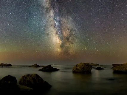
Some petroforms were used as astronomical calendars,
With rocks aligned to solstice and equinox sunrises and sunsets.
They are often found in higher areas on hills,
Mounds,
Ridges,
And natural rock formations.
Higher ground allowed humans to carefully observe the rocks.
Horizons to mark and measure astronomical events.
Some rock alignments point out four or more directions,
Lunar events,
The rising and setting of planets,
Some stars,
And other astronomical events.
Some petroforms can also be used in more complex ways for astronomical predictions.
Mapping of the sky and ground.
And for complex ceremonies that help to memorize many oral stories and songs.
Petroforms are similar in some ways to medicine wheels,
Which are also aligned with sunrises and sunsets,
Equinoxes,
Solstices,
Lunar events,
And star patterns.
Petroforms also mirrored the night sky and the patterns of the stars,
Similar to astrological signs and symbols.
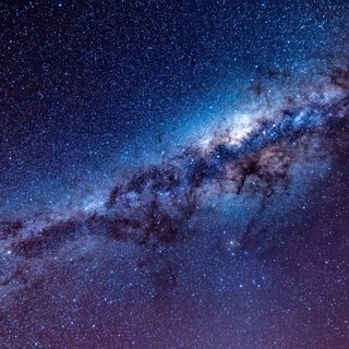
The Sioux have oral traditions of the serpent in the sky,
A turtle,
A bear,
And other patterns seen in the stars.
What is often known today as Orion's Belt was one prominent bright star formation,
Along with the central and stationary North Star,
Now named as Polaris.
What is not known as the planet Venus is the very bright morning and evening star that is very noticeable and at times is the first and last to appear.
Petroform sites in North America can be found in Manitoba,
Saskatchewan,
Alberta,
Wisconsin,
Minnesota,
Wyoming,
Montana,
Along the Mississippi River,
The Missouri River,
And elsewhere.
It has been suggested that megalithic monuments,
Including Stonehenge,
May have incorporated important astronomical alignments.
The desert kites of Syria,
Jordan,
And the Negev,
Long lines of stones,
Are interpreted as aids to hunting large game animals like gazelles,
Ibexes,
And wild asses.
There are similar structures on most continents.
The Inuksuit of the Arctic act as navigation aids,
An aid for hunting,
Or to mark important locations.
The rock marker helped the traveler or hunter to find the best route across the land.
Someone left a marker to help anyone else passing through the area,
And to help with not getting lost.
These markers can have very practical and universal purposes.
Some petroforms are located along portage routes and canoe routes as well.
Human-made markers can be easier to remember than common natural features of the landscape.
Rock ridges would have been natural trails through dense forest or wet terrain.
Whiteshell Provincial Park petroforms are located on top of the granite ridges that snake through the forest and wetlands landscape.
The dolmens widespread in Europe and much of Asia are interpreted as neolithic burial chambers.
Large boulders make excellent long-term markers for important and sacred places,
Just as burial plots are marked by large stones today.
Some petroforms could be close to ancient burial areas,
Or near sacred areas associated with the dead.
Large rocks are a universal marker that can last for generations.
Boulders will last for tens of thousands of years.
In memory of a person or the history about a place,
These markers help future generations to learn about the past.
These markers help to provide long-term memories and reminders of the past.
These rock shapes are used to memorize and to help tell stories and legends.
Some petroforms go in the order of the story,
Helping one to memorize the successive steps.
Large rocks are very popular in the world today.
Some large boulders in North America have long stories that relate to the area and a memory about that place.
A large boulder sitting alone catches the eye as a major landmark.
Many petroforms in Whiteshell Provincial Park have long stories associated with each one.
Aboriginal groups also made shapes of humans,
Snakes,
Turtles,
Fish,
Bears,
Cougars,
Thunderbirds,
Medicine wheels,
Circles,
Rectangles,
And other complex geometric shapes that are still intact today.
There is certainly an attempt to leave their mark upon the landscape,
And large boulders or rocks are very permanent markers.
The Nazca lines include many animal and other shapes.
Petroforms in North America are often related to earthen mounds.
Mounds were sometimes built over the older petroforms or later made near them.
Petroforms also marked out the area for various ceremonies,
Sweat lodges,
Fasting,
And sacred fires.
They often mark an important or sacred area or point to an important place.
Offerings and prayers are made in these areas along with initiations and vision quests.
The exact original purposes of the Karnak stones,
Stonehenge,
And many other megalithic monuments are lost.
One of the locations of petroform sites,
Including effigies,
Is in southeastern Manitoba in Whiteshell Provincial Park,
Canada.
Whiteshell Park is named after the white cowrie shells used by some Anishinaabe peoples in ceremonies.
The natural landscape of the park,
With many movable rocks and boulders left behind after the last ice age,
Gave humans the easy opportunity to arrange them into many human-made patterns.
It is an area where three rivers meet along the edge of the Canadian Shield,
Close to the edge of prairie grasslands.
The rivers were ancient highways and trade routes,
Bringing humans from far and wide to the area.
Some large boulders appear to be carved,
Chipped,
Or altered to look like turtle heads and other animals.
A very wide variety of petroform shapes are found in the park,
Including snakes,
Turtles,
Geometric lines,
Patterns,
And large circles.
Most of the known petroforms are found on the top of granite ridges.
The granite ridges and hills are often very flat in areas,
Resembling a large concrete parking lot.
These open areas have a very smooth granite left behind from the last ice age.
In some areas,
There is no soil,
No lichen,
And the surface is polished to a shine.
The large boulders aligned are in striking contrast to the flat granite beneath them.
Local First Nations have teachers and elders that pass along the stories associated with some of these petroforms.
Many of the sites and their past use is a mystery with no certain answers.
Some elders refer to one site as extremely sacred and important,
And few people should venture there.
The Midewiwin have oral teachings about some of the petroforms,
But no one group claims to know all the history of the area.
The petroform sites in Wisconsin are being studied more closely and can be dated more easily because of soil deposits over centuries.
Many other sites have no layers of soil deposited around the petroforms.
Forested areas and soil cover have partially protected many of the petroforms in Wisconsin and Minnesota.
In many areas across the prairies,
Large circular medicine wheels were made as astronomical devices,
Directional maps,
And for ceremonial use.
Some of these medicine wheels are large,
And many were destroyed for agricultural needs by clearing the grasslands of any rocks.
Some are intact,
Such as in the Turtle Mountains and other sandy,
Rocky,
Or more remote areas that had less crop farms and settlements.
Mound building was also associated in some way with petroform use.
Petroforms originally predated the use of mounds and other human-made earthenworks that required more time and effort.
Although mound building could have originally been necessary and practical to provide some higher ground during floods,
There is some speculation that larger mounds would have served as dikes and defensive fortifications,
Including providing higher ground to keep watch.